Guinea Map 3D Model – Realistic Satellite Terrain, 18K Textures
File Formats
Native Format
Exchange Formats
Features
3D Features
Geometry
Unwrapped UVs
Download information
After purchase, you will receive an email within several hours with a download link to access your files.
Description
Explore the stunning detail of our Guinea Map 3D Model, featuring realistic satellite terrain with 18K resolution textures. Perfectly crafted for geographical visualizations, this asset showcases the rich topography and intricate details of Guinea's landscapes.
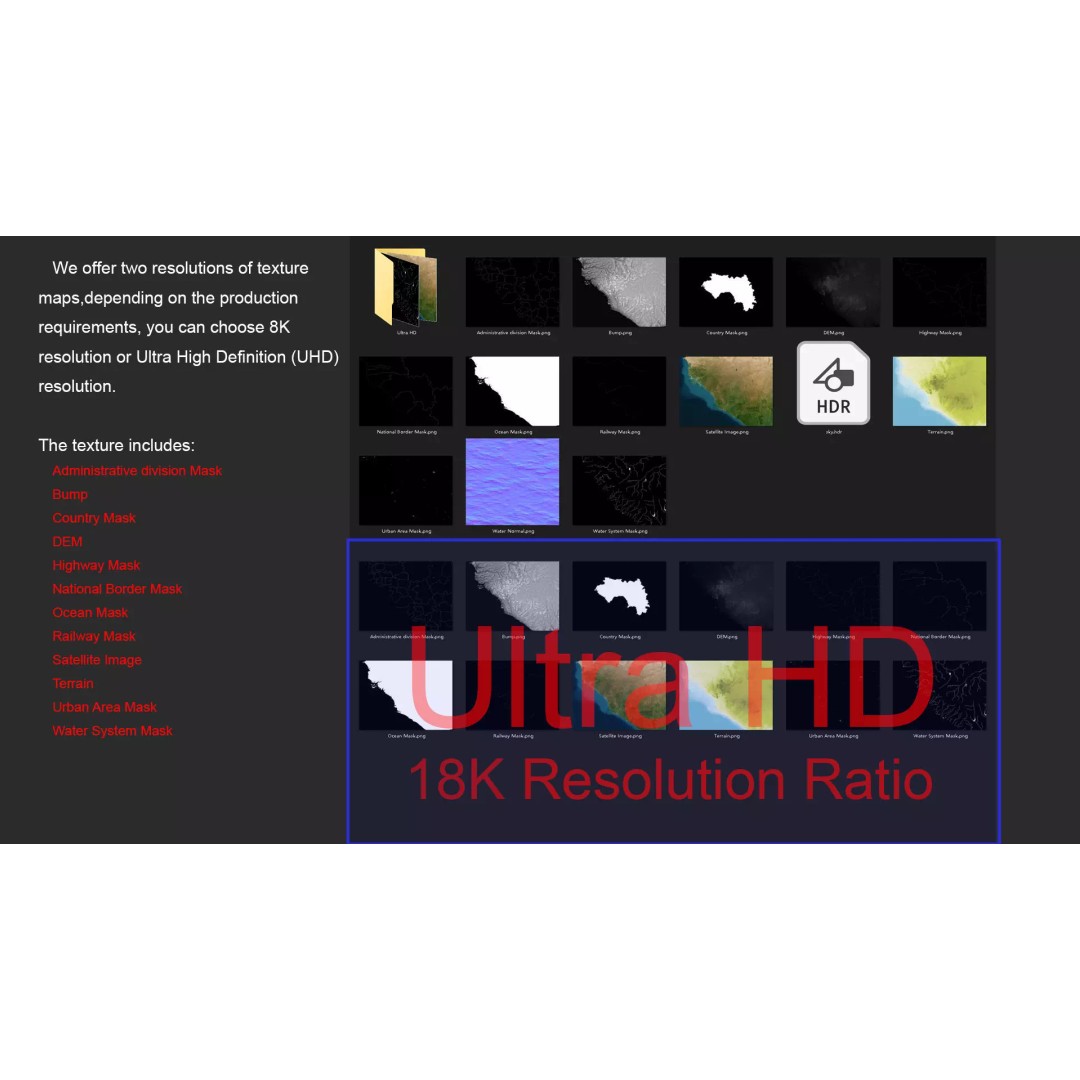
Designed for professionals and creatives alike, this model comes with high-quality satellite imagery and various masks for precise material blending, ensuring an accurate representation of the terrain. The model includes advanced texture maps at 8K and 18K resolutions, allowing for impressive visual fidelity, whether you're working on a game, animation, or an architectural visualization project.
- Formats: MAX, FBX, OBJ, STL
- Polygons: 720,000 - 11,520,000
- Native: 3ds Max with V-Ray materials
- High-resolution satellite imagery with Photoshop correction
- Displacement maps with ≥ 30-meter accuracy
- Rich surface details with bump mapping
- Includes masks for national borders, water systems, and urban areas
This model is ideal for game developers, animators, and architects looking to add realistic terrain to their projects. With its comprehensive detail and versatile file formats, the Guinea Map 3D Model is a must-have asset for any digital environment.
Download now and elevate your projects with this extraordinary terrain model!