Nigeria Map 3D Model – Realistic Satellite Terrain, FBX/OBJ
File Formats
Native Format
Exchange Formats
Features
3D Features
Geometry
Unwrapped UVs
Download information
After purchase, you will receive an email within several hours with a download link to access your files.
Description
Explore the captivating landscape of Nigeria with our Nigeria Map 3D Model, featuring a highly detailed realistic satellite terrain designed for various applications.
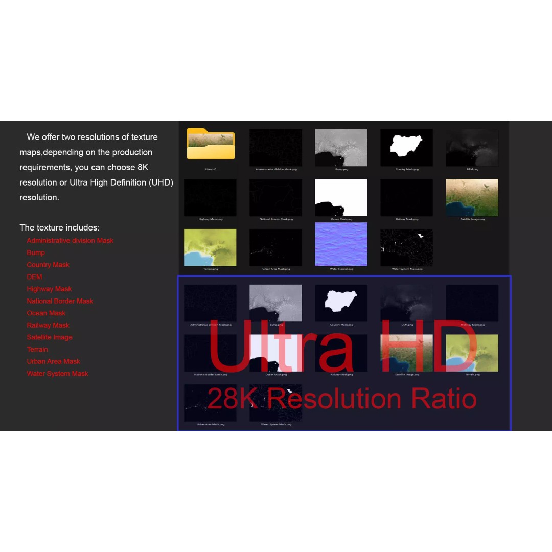
This model boasts an impressive polygon count ranging from 720,000 to 11,520,000, ensuring stunning detail and accuracy. With textures available in both 8K and 28K resolutions, it provides a rich representation of the terrain, making it ideal for visualization projects, educational purposes, or game development.
- Formats: MAX, FBX, OBJ, STL
- Polygon Count: 720,000 to 11,520,000
- Model Size: 1000 M x 846 M
- Projection: Mercator GCS_WGS_1984
- Textures: Satellite imagery, DEM, bump maps, and color maps
- UV Mapping: Non-overlapping
- Compatibility: V-Ray materials converted for standard applications
This model is perfect for game developers, architects, and educators looking to enhance their projects with realistic geographic representations. The detailed elevation data and various masks for national borders, urban areas, and waterways make it a versatile asset for any visualization needs.
Download now and elevate your projects with this comprehensive Nigeria Map 3D Model, available in multiple formats for your convenience!