Nepal Map 3D Model – Realistic Satellite Terrain, FBX, OBJ, MAX
File Formats
Native Format
Exchange Formats
Features
3D Features
Geometry
Unwrapped UVs
Download information
After purchase, you will receive an email within several hours with a download link to access your files.
Description
Explore the breathtaking landscapes of Nepal with this highly detailed Nepal Map 3D Model. Featuring realistic satellite terrain, this asset is perfect for a variety of projects, including geographic visualizations, educational tools, and immersive environments.
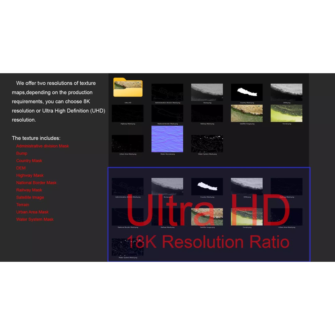
Crafted with precision, this model includes a comprehensive set of textures and materials that enhance its visual appeal. The use of high-resolution satellite imagery (up to 18K) ensures that every detail is captured, providing an authentic representation of Nepal's diverse terrain.
- Formats: FBX, OBJ, STL, Native MAX
- Polygon Count: 720,000 - 11,520,000
- Projection: Mercator GCS_WGS_1984
- Textures: Includes 8K and 18K resolution satellite imagery, DEM, and bump maps
- Detailed Masks: National borders, country, administrative divisions, water systems, and urban areas
- Unwrapped UVs: Non-overlapping for seamless texturing
This model is ideal for developers, artists, and educators who require a detailed geographical representation for games, archviz, or educational presentations. With its extensive features and high fidelity, it’s designed to meet the needs of professionals seeking quality assets.
Ready to elevate your project? Download now and bring the beauty of Nepal to life!