Myanmar Map 3D Model – Realistic Satellite Terrain, FBX & OBJ Formats
File Formats
Native Format
Exchange Formats
Features
3D Features
Geometry
Unwrapped UVs
Download information
After purchase, you will receive an email within several hours with a download link to access your files.
Description
Discover the stunning Myanmar Map 3D Model, a highly detailed representation of the terrain generated from real satellite imagery. Perfect for visualization projects, this model showcases intricate elevation data and geographical features.
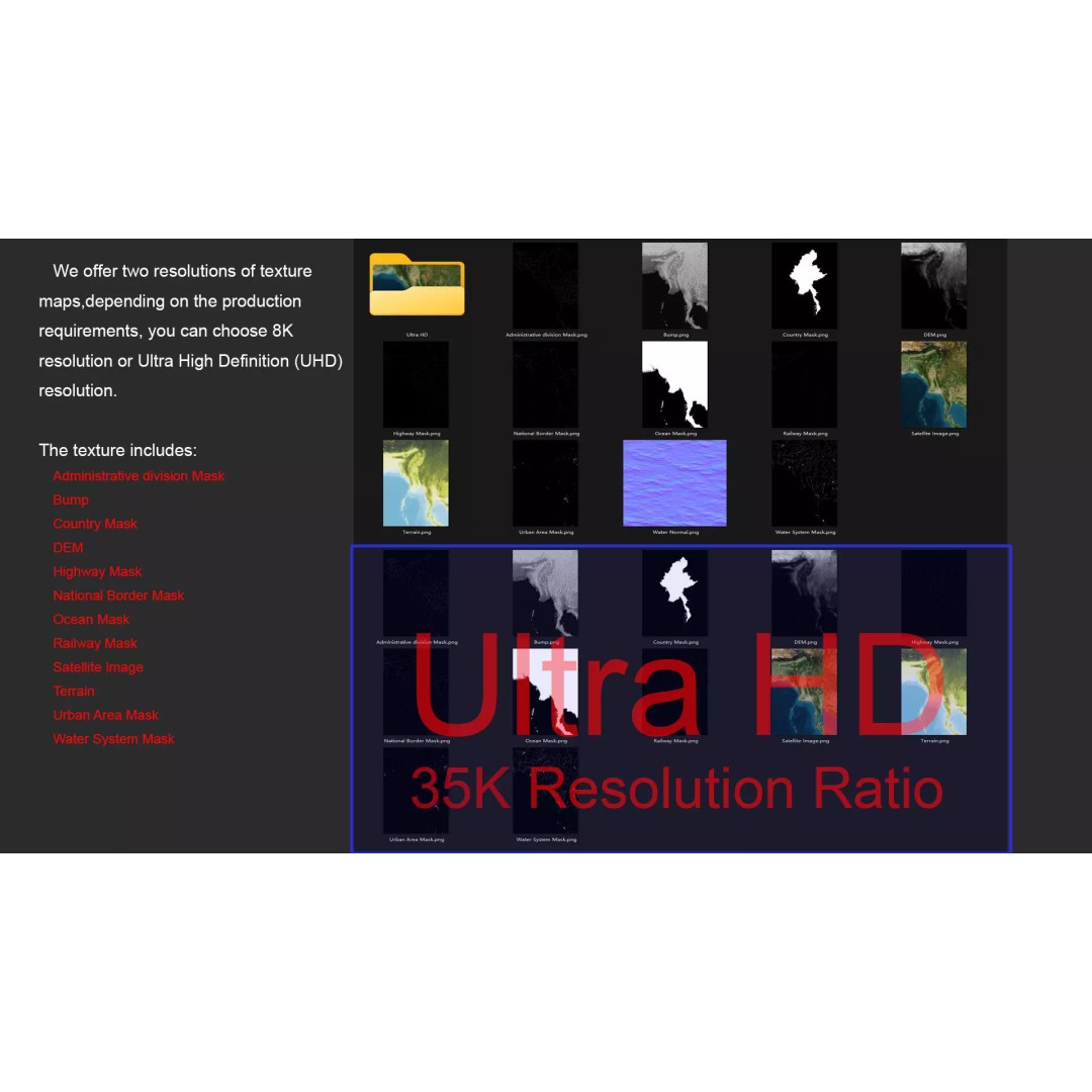
With a polygon count ranging from 720,000 to 11,520,000, this model ensures an exceptional level of detail, making it ideal for archviz, educational purposes, and game development. The model includes textures and materials that enhance realism, featuring both 8K and 35K resolution satellite imagery, which has been meticulously corrected for cloud coverage.
- Formats: MAX, FBX, OBJ, STL
- Polygons: 720,000 - 11,520,000
- Projection: Mercator GCS_WGS_1984
- Displacement Map: Accurate elevation data with ≥ 30-meter precision
- UV Mapping: Non-overlapping
- Includes multiple masks for national borders, urban areas, and waterways
This terrain model is particularly useful for developers and designers working in Unity or Unreal Engine, offering a comprehensive solution for creating realistic environments. Whether you’re looking to create a detailed geographic representation or integrate realistic terrain into your projects, this model is ready for use.
Download now to elevate your visual projects with this high-quality 3D terrain model!