Mozambique Map 3D Model – Realistic Satellite Terrain, FBX, OBJ
File Formats
Native Format
Exchange Formats
Features
3D Features
Geometry
Unwrapped UVs
Download information
After purchase, you will receive an email within several hours with a download link to access your files.
Description
Explore the stunning detail of our Mozambique Map 3D Model, featuring realistic satellite terrain that captures the beauty of this African nation. Ideal for geographic visualization and educational projects, this model integrates high-resolution satellite imagery for an immersive experience.
Crafted with precision, this 3D model includes advanced features such as textures, materials, and non-overlapping UV mapping. The model is designed in Autodesk 3ds Max, utilizing V-Ray materials and rendered to achieve exceptional realism. With polygon counts ranging from 720,000 to 11,520,000, it provides a rich visual experience suitable for various applications.
- Formats: MAX, FBX, OBJ, STL
- Polygons: 720,000 – 11,520,000
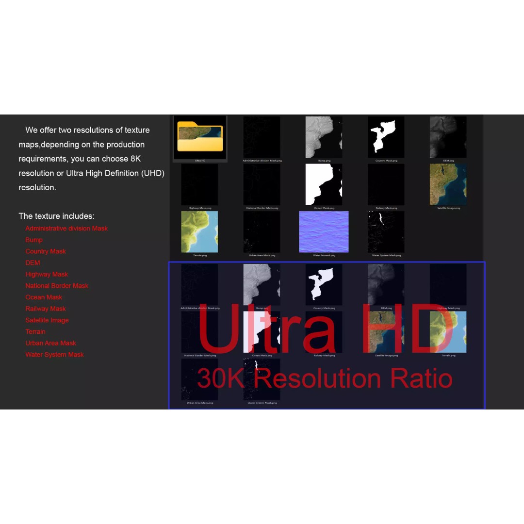
- Resolution: 8K and 30K texture maps
- High-resolution satellite imagery with Photoshop correction
- Terrain color maps generated from elevation data
- Includes several masks for national borders, water systems, and urban areas
This model is perfect for game developers, animators, and those in the field of archviz looking to create realistic environments. Whether you are developing a simulation or an educational tool, this asset provides a reliable foundation for your project.
Download now to enhance your 3D projects with this comprehensive Mozambique Map 3D Model!