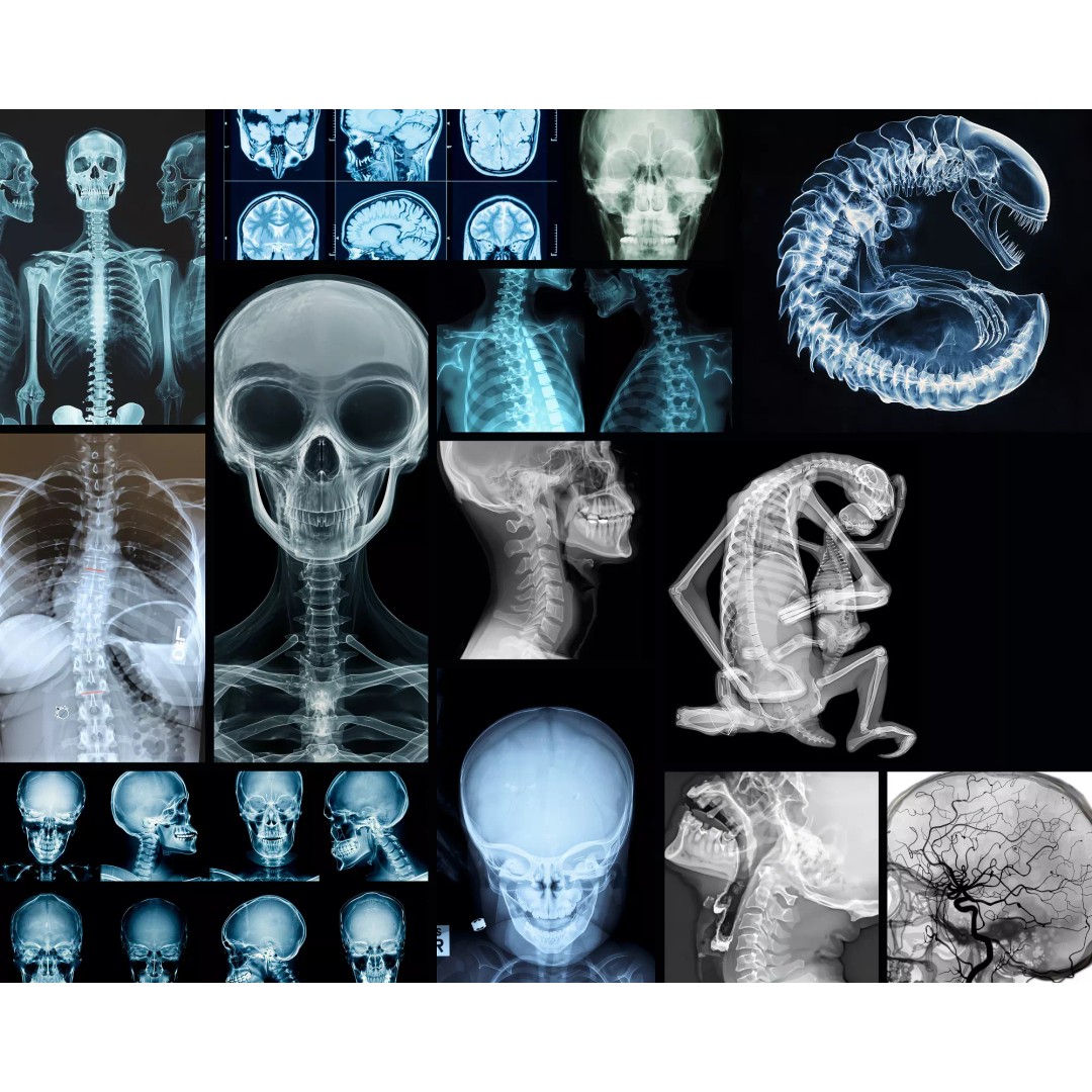
0
Signup
Google Logo

Exterior & Interior Design / Springfield - Missouri Low-poly 3D model

Springfield - Missouri Low-poly 3D model

Description


Verification details of the FBX file
Files
Scene
Geometry
Textures and Materials
UVs
Naming
  • Coordinate reference system: NAD83 / UTM zone 15N (EPSG:26915)
  • Scene size: up to 30 x 30 km
  • Units: Meters
  • Scale: 1 : 1
  • Data used: October 2022
  • SEND US A MESSAGE
    • Get FREE sample model
    • Flexible pricing and discounts
    • Customization and adjustments
      • Any scene size (custom area crop)
      • Any coordinate reference system
      • Various levels of detail (LODs)
      • Update to the latest data
  • PACKAGE CONTENTS
    • This product includes scenes of various sizes and formats
    • File formats (software supported)
      • MAX - Autodesk 3dsMax
      • FBX, OBJ, DAE - Exchange Formats
      • GLB, GLTF - Games, Web, AR/VR
      • UNITYPACKAGE - Unity 3D
      • 3DM - Rhino 3D
      • SKP - SketchUp
      • RVT - Autodesk Revit
      • STL - 3D Print (request)
      • C4D - Cinema4D
      • BLEND - Blender
      • MA, MB - Autodesk Maya
      • DWG, DXF - Autodesk AutoCAD
  • BASIC OPTIONS (included with the purchase)
    • KEY BENEFITS
      • 24/7 customer support
      • Regular updates and improvements
      • High-resolution surface texture (1 meter resolution satellite image)
      • 100% buildings coverage from buildings footprint polygon geometries in all 50 U.S. States
      • Buildings, landuse areas, roads and railways split by type (layers / named objects)
      • The surface is flat, easy to add details and edit geometry (terrain on request)
      • Realistic low-poly trees and forests (max, fbx included, other formats on request)
      • Product is ready to render out-of-the-box (3ds Max + Corona Renderer)
    • PRESENTATION IMAGES
      • 4K high-resolution realistic renderings (refer to images for level of detail)
      • Rendered in 3dsMax (other software requires its own rendering settings)
    • MATERIALS
      • Trees, vegetation, landuse and airport surface with the textures assigned
      • Buildings are UVW mapped, split by material IDs, no textures assigned
  • CUSTOM OPTIONS
    • TOPOGRAPHY TERRAIN
      • Up to 1 meter accuracy raw terrain object (USGS 3D Elevation Program)
      • Multiple LODs optimized for the best polycount/details balance
      • Contour lines (up to 1 meter interval)
      • High-resolution (up to 20cm accuracy) satellite or surface texture
      • Buildings and roads placed on the optimized terrain
      • Starting from $999
    • OTHER EXTRAS
      • Custom on-demand update
      • Crop to custom area size or slice to tiles
      • Procedural textures assigned to all buildings
      • Individual buildings and streets (with address and/or name)
      • Administrative boundaries of all levels (named polygons or outlines)
      • Road and railway splines for traffic animation
      • Public transport stops with names
      • Extra charge, ask before purchase
  • city
  • map
  • area
  • building
  • skyline
  • suburb
  • downtown
  • sketchup
  • rhino
  • unity
  • springfield
  • missouri
  • model
  • urban
  • center
  • park
  • landscape
  • topography
  • airport
  • street
  • exterior
  • cityscape
$438.9
Royalty Free License

Formats


Collada
.dae
47.7 MB
Cinema 4D
.c4d
20.6 MB
Blender
.blend
38.7 MB
Autodesk 3ds Max
.max
136 MB
Rhinoceros 3D
74.9 MB
Autodesk Maya
.ma, .mb
37.6 MB
OBJ
.obj, .mtl
39.5 MB
Autodesk FBX
.fbx
73.8 MB
Unity 3D
75.3 MB
AutoCAD
.dwg
64.4 MB
Sketchup
87.9 MB

Model Details


Publish date
12.11.2024

Model uid
44479d5bd482d56d

Animated

Rigged

VR / AR / Low-poly

Geometry
Polygon mesh

Polygons
1

Vertices
1

Textures

Materials

UV Mapping

Unwrapped UVs

Plugins used

Ready for 3D Printing
Signup
Google Logo

Cart Details


Total order amount: $0