Cambodia Map 3D Model – Realistic Satellite Terrain with DEM, FBX, OBJ
File Formats
Native Format
Exchange Formats
Features
3D Features
Unwrapped UVs
Download information
After purchase, you will receive an email within several hours with a download link to access your files.
Description
Discover the breathtaking Cambodia Map 3D Model, featuring a highly detailed realistic satellite terrain designed for various applications. This model is ideal for visualization, geography projects, and educational purposes.
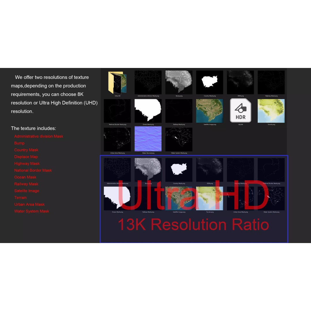
With a polygon count ranging from 720,000 to 11,520,000, this high-quality asset provides exceptional detail and realism. The included textures are available in both 8K and 13K resolutions, ensuring that your renderings showcase the stunning terrain accurately. The model is created using advanced techniques, including DEM (Displacement Map) and bump maps generated from elevation data with ≥ 30-meter accuracy, enhancing surface details and depth.
- Formats: MAX, FBX, OBJ, STL
- Native Software: Autodesk 3ds Max with V-Ray materials
- Polygons: 720,000 - 11,520,000
- Size: 1000 M x 944 M
- Textures: 8K and 13K resolutions
- High-Resolution Satellite Imagery: Level 12 (1:288,895)
- Accurate DEM and Bump Maps: ≥ 30-meter accuracy
- Multiple Masks: National borders, administrative divisions, water systems, and urban areas
This asset caters to a wide range of users, including game developers, architects, and educators looking for detailed geographical representations. Whether you're creating immersive experiences in Unity or Unreal Engine, or working on educational content, this model is a perfect fit.
Download now to access this versatile and detailed Cambodia Map 3D Model, ready for your next project!