China Map 3D Model – Realistic Satellite Terrain, FBX, OBJ, MAX
File Formats
Native Format
Exchange Formats
Features
3D Features
Geometry
Unwrapped UVs
Download information
After purchase, you will receive an email within several hours with a download link to access your files.
Description
Explore the breathtaking landscapes of China with this highly detailed China Map 3D Model, featuring realistic satellite terrain imagery. Ideal for geographic visualization, this model offers an impressive level of detail and accuracy.
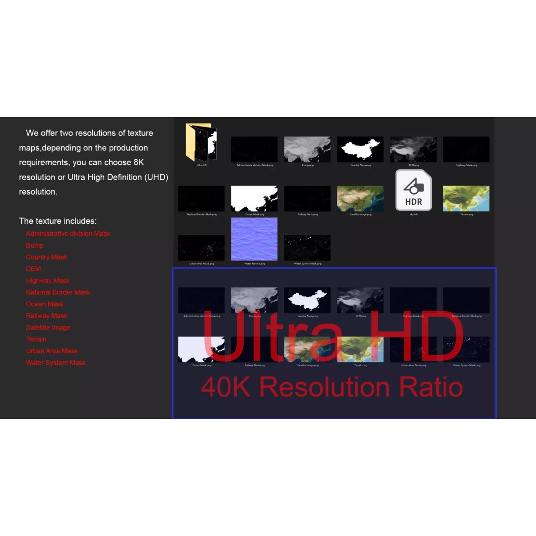
Crafted with meticulous attention to detail, this model includes high-resolution satellite imagery and masks for enhanced material blending. With texture maps available in both 8K and 40K resolutions, you can achieve stunning visual fidelity in your projects. The Displacement Map and Bump Map, generated from elevation data with high accuracy, provide rich surface details that bring the terrain to life.
- Formats: MAX, FBX, OBJ, STL
- Polygon Count: 720,000 – 11,520,000
- Model Size: 1000 M x 591 M
- Projection: Mercator GCS_WGS_1984
- Unwrapped UVs: Non-overlapping
- High-quality textures with 8K and 40K resolution
This model is perfect for use in game development, architectural visualization, and animation, providing a realistic representation of China's diverse terrain. Whether you're creating educational content, simulations, or artistic projects, this asset will elevate your work.
Download now to access this versatile China Map 3D Model in various formats and enhance your creative projects!