Honduras Map 3D Model – Realistic Satellite Terrain, 16K Textures
File Formats
Native Format
Exchange Formats
Features
3D Features
Geometry
Unwrapped UVs
Download information
After purchase, you will receive an email within several hours with a download link to access your files.
Description
Discover the stunning realism of our Honduras Map 3D Model, featuring high-resolution satellite terrain and detailed elevation data. Perfect for geographic visualizations, this model combines accuracy with visual appeal.
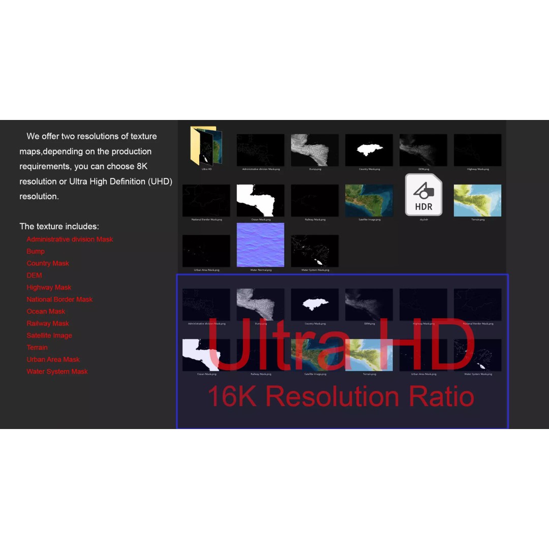
Crafted with precision, this 3D model includes advanced features such as 16K textures and multiple masks for national borders, urban areas, and water systems. The satellite imagery is enhanced with Photoshop correction for clarity, while the DEM (Displacement Map) and bump maps provide depth and detail, ensuring a lifelike representation of Honduras' diverse landscapes.
- File Formats: MAX, FBX, OBJ, STL
- Polygons: Ranges from 720,000 to 11,520,000
- Model Size: 1000 M x 727 M
- Projection: Mercator GCS_WGS_1984
- Texture Resolutions: Available in 8K and 16K
- UV Mapping: Non-overlapping
This model is ideal for game developers, architects, and animators looking to incorporate realistic terrain into their projects. Whether you're creating educational content, simulations, or artistic representations, this asset provides the quality and detail you need.
Ready for download, this model is compatible with various 3D software, making it easy to integrate into your workflow. Get your Honduras Map 3D Model today!