Brazil Map 3D Model – Realistic Satellite Terrain, 40K Textures, FBX/OBJ
File Formats
Native Format
Exchange Formats
Features
3D Features
Geometry
Unwrapped UVs
Download information
After purchase, you will receive an email within several hours with a download link to access your files.
Description
Discover the stunning realism of the Brazil Map 3D Model, featuring detailed satellite terrain imagery in a high-resolution format. This asset is perfect for visualizing geographical data with incredible accuracy.
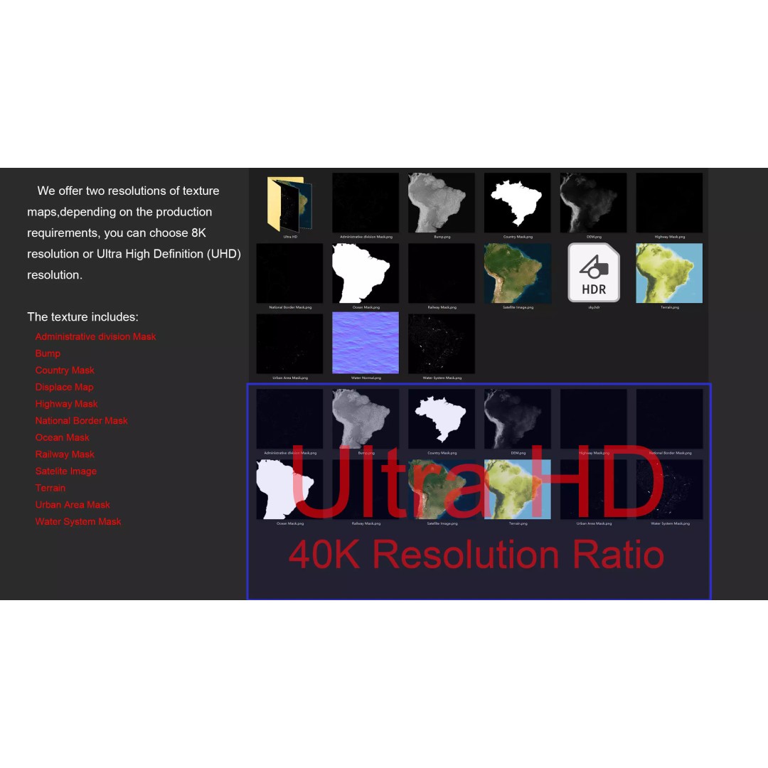
With a polygon count ranging from 720,000 to 11,520,000, this model offers a robust and versatile foundation for various applications. The inclusion of both 8K and 40K texture maps allows for breathtaking detail, ensuring that your projects stand out. The satellite imagery is corrected for cloud cover, providing a clear and vibrant representation of Brazil's diverse landscapes.
- Formats: MAX, FBX, OBJ, STL
- Geometry: Polygon mesh with non-overlapping UVs
- Textures: 40K resolution with displacement and bump maps
- Projection: Mercator GCS_WGS_1984
- Includes national borders, administrative divisions, and water systems
This model is ideal for game developers, architects, and visual effects artists looking to enhance their projects with realistic geographical representations. Whether you are creating an animated presentation or a detailed simulation, the Brazil Map 3D Model will serve as a valuable resource.
Download now and elevate your visual storytelling with this exceptional asset!