French Guiana Map 3D Model – Realistic Satellite Terrain, FBX, OBJ
File Formats
Native Format
Exchange Formats
Features
3D Features
Geometry
Unwrapped UVs
Download information
After purchase, you will receive an email within several hours with a download link to access your files.
Description
Explore the stunning detail of the French Guiana Map 3D Model, a highly realistic satellite terrain representation perfect for various applications.
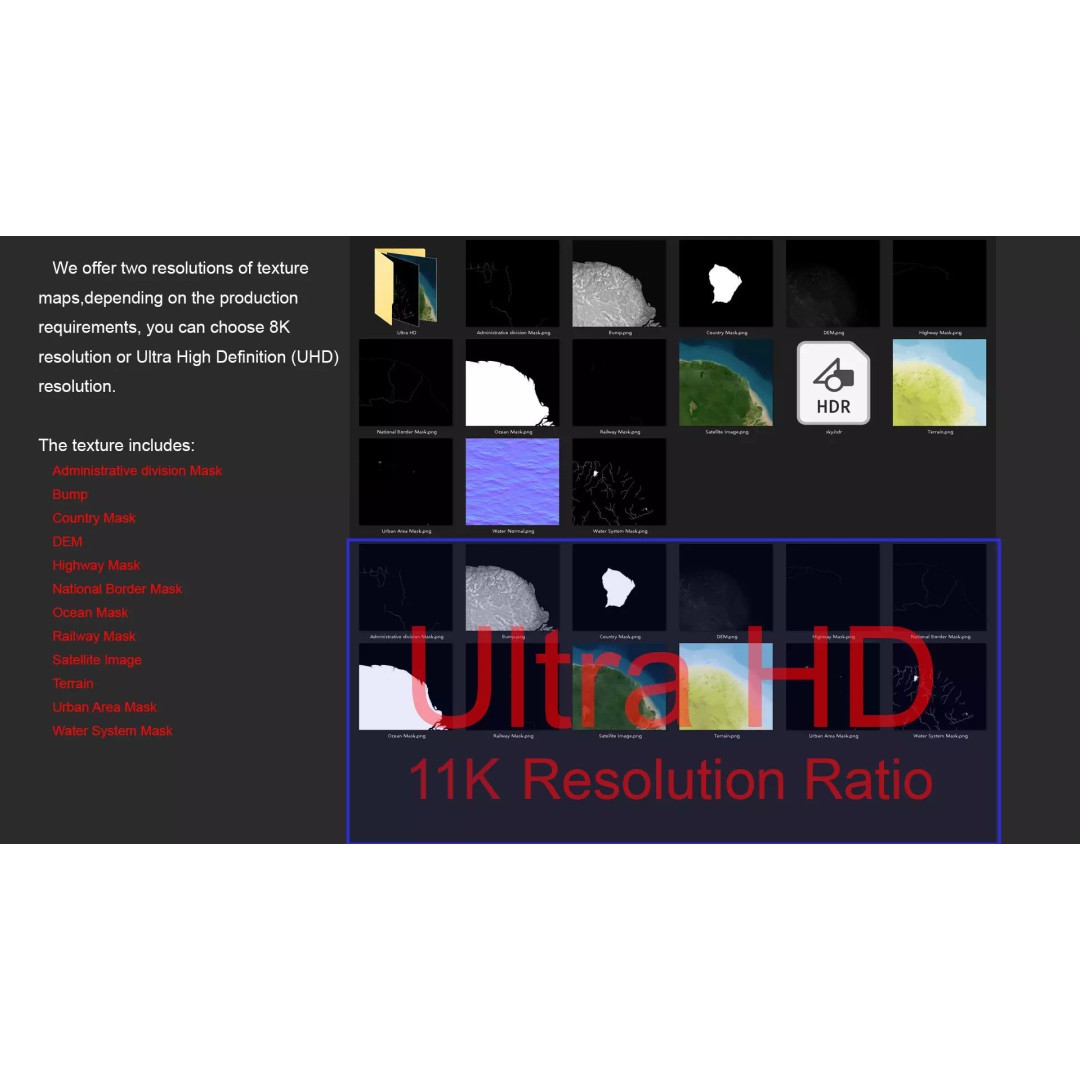
This model features intricate elevation data and textures that reflect the geographical nuances of French Guiana. With textures available in 8K and 11K resolutions, you can achieve exceptional visual fidelity, whether for video games, architectural visualization, or educational projects.
- Formats: MAX, FBX, OBJ, STL
- Polygons: 720,000 to 11,520,000
- Projection: Mercator GCS_WGS_1984
- High-resolution satellite imagery with Photoshop correction
- Detailed terrain color maps based on elevation data
- Includes various masks for national borders, water systems, and urban areas
- Non-overlapping UVs for easy texturing
This 3D model is ideal for game developers, animators, and anyone in need of a realistic geographical asset. Its thorough testing ensures compatibility across various platforms, making it a versatile addition to your asset library.
Download now to elevate your project with this comprehensive terrain model.