Georgia Map 3D Model – Realistic Satellite Terrain with Textures
File Formats
Native Format
Exchange Formats
Features
3D Features
Geometry
Unwrapped UVs
Download information
After purchase, you will receive an email within several hours with a download link to access your files.
Description
Discover the stunning Georgia Map 3D Model, showcasing a highly detailed realistic satellite terrain. This model is perfect for geographical visualization and offers a rich visual experience.
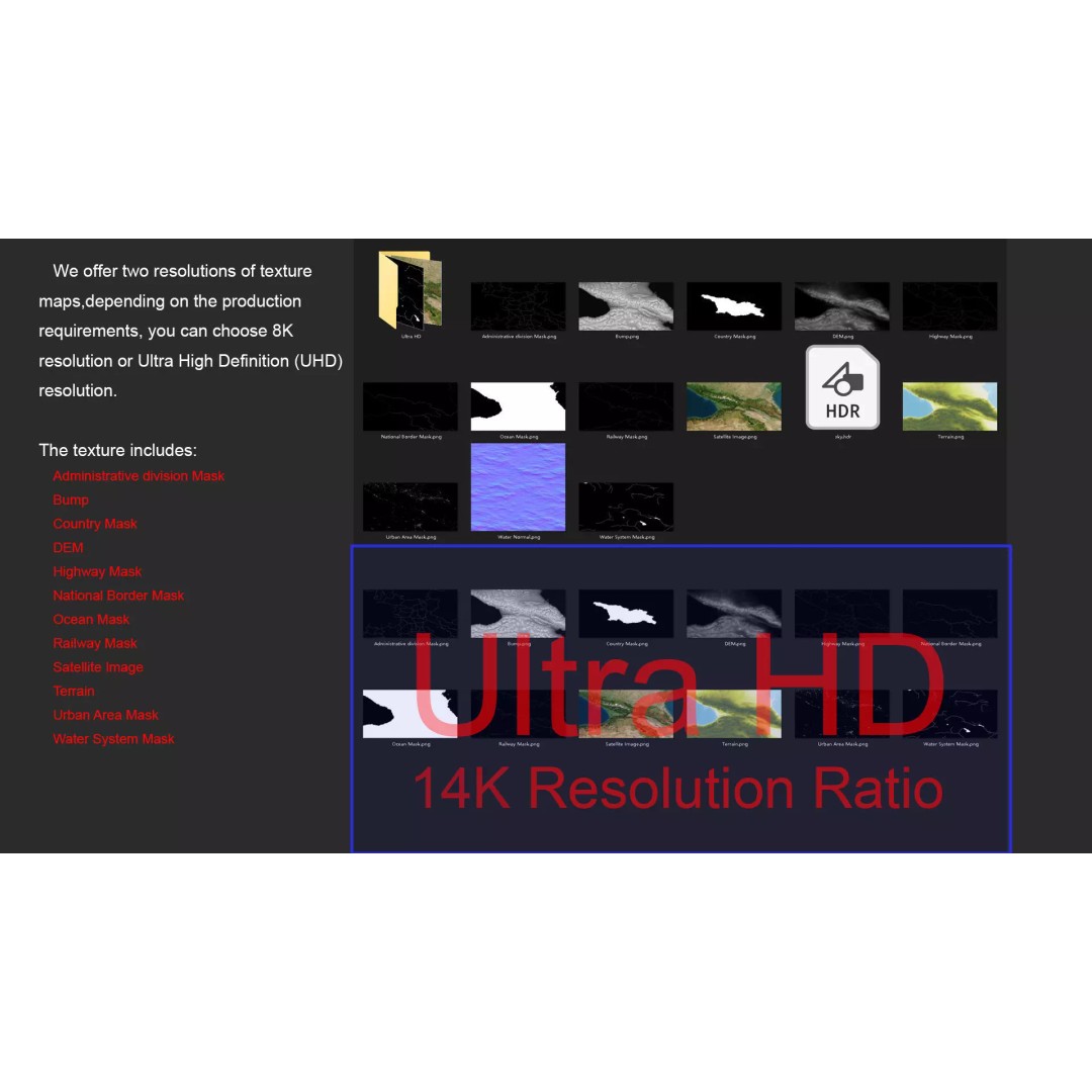
With over 720,000 to 11,520,000 polygons, this model ensures high fidelity and accuracy in representing terrain features. The included satellite imagery and masks enhance material blending, allowing for a realistic depiction of Georgia's landscape. The model features textures available in both 8K and 14K resolutions, ensuring striking visuals for various applications.
- Format: MAX, FBX, OBJ, STL
- Native Software: Autodesk 3ds Max with V-Ray materials
- Polygon Count: 720,000 to 11,520,000
- Model Size: 1000 m x 550 m
- Projection: Mercator GCS_WGS_1984
- Includes: DEM, bump maps, color maps, and various masks (national borders, country, administrative divisions, water systems, urban areas, etc.)
- Texture Resolution: Textures up to 14K
This model is ideal for game developers, architects, and educators looking to visualize geographical data or enhance their projects with realistic terrain. Whether you are creating simulations, educational materials, or immersive environments, the Georgia Map 3D Model serves as an excellent asset.
Download now and elevate your project with detailed terrain visuals!