Finland Map 3D Model – Realistic Satellite Terrain, FBX, OBJ
File Formats
Native Format
Exchange Formats
Features
3D Features
Geometry
Unwrapped UVs
Download information
After purchase, you will receive an email within several hours with a download link to access your files.
Description
Explore the stunning terrain of Finland with our Realistic Satellite Terrain 3D Model. This high-quality asset features intricate details derived from accurate elevation data, making it perfect for a range of applications.
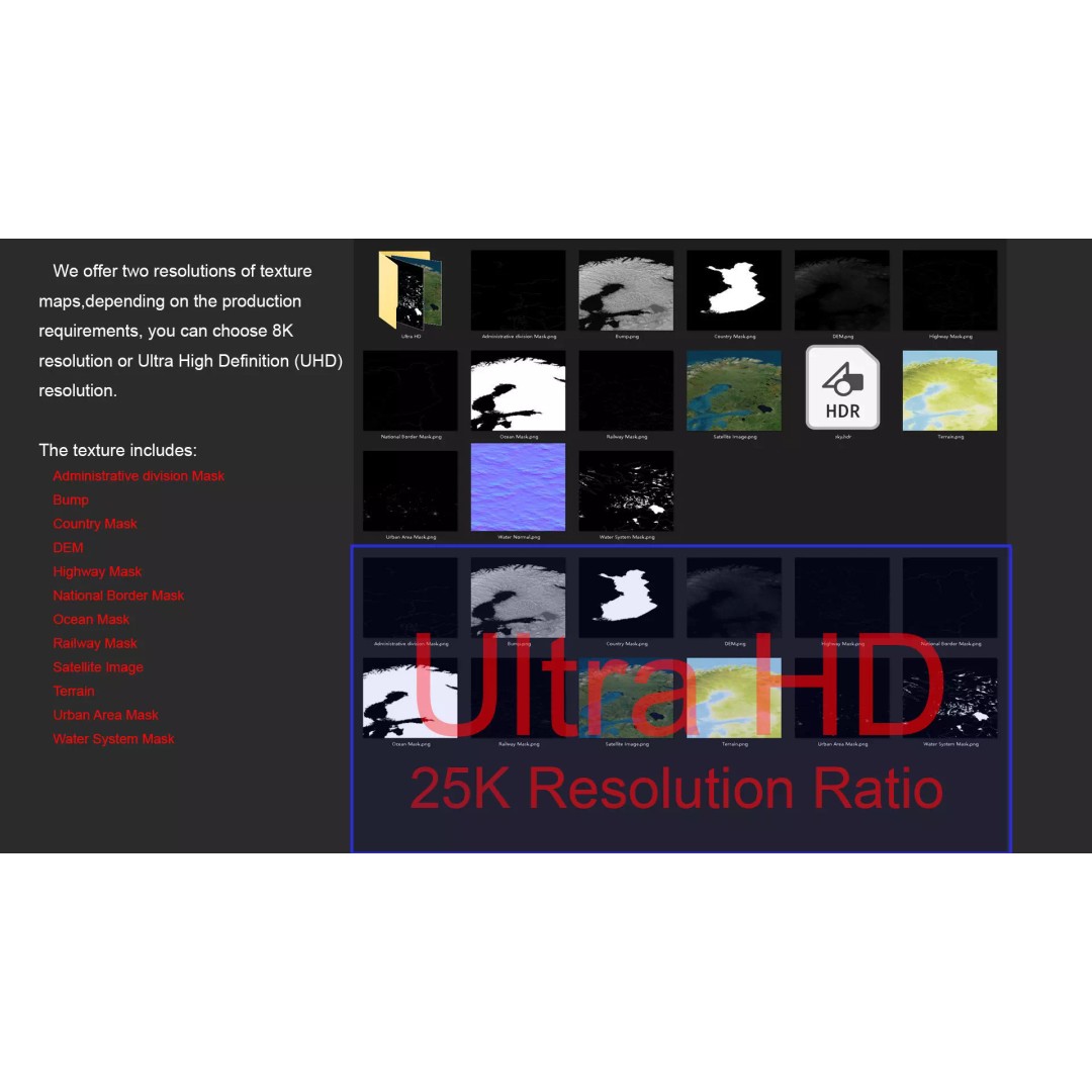
The 3D model includes textures at resolutions of 8K and 25K, allowing for exceptional visual fidelity. The satellite imagery has been meticulously processed to ensure clarity and detail, even in areas typically affected by cloud cover. With a polygon count ranging from 720,000 to 11,520,000, it offers a rich and immersive experience.
- Multiple formats available: MAX, FBX, OBJ, STL
- Native file format: Autodesk 3ds Max with V-Ray materials
- Detailed displacement maps generated from elevation data
- Comprehensive masks for national borders, water systems, and urban areas
- Non-overlapping UV mapping for seamless texturing
- High-resolution color maps to represent altitude visually
This model is ideal for game development, architectural visualization, and educational projects. It provides a realistic representation of Finland's geography, enhancing any visual or interactive experience.
Download now to elevate your projects with this detailed terrain asset!