Albania Map 3D Model – 8K Realistic Terrain with DEM Data, FBX/OBJ
File Formats
Native Format
Exchange Formats
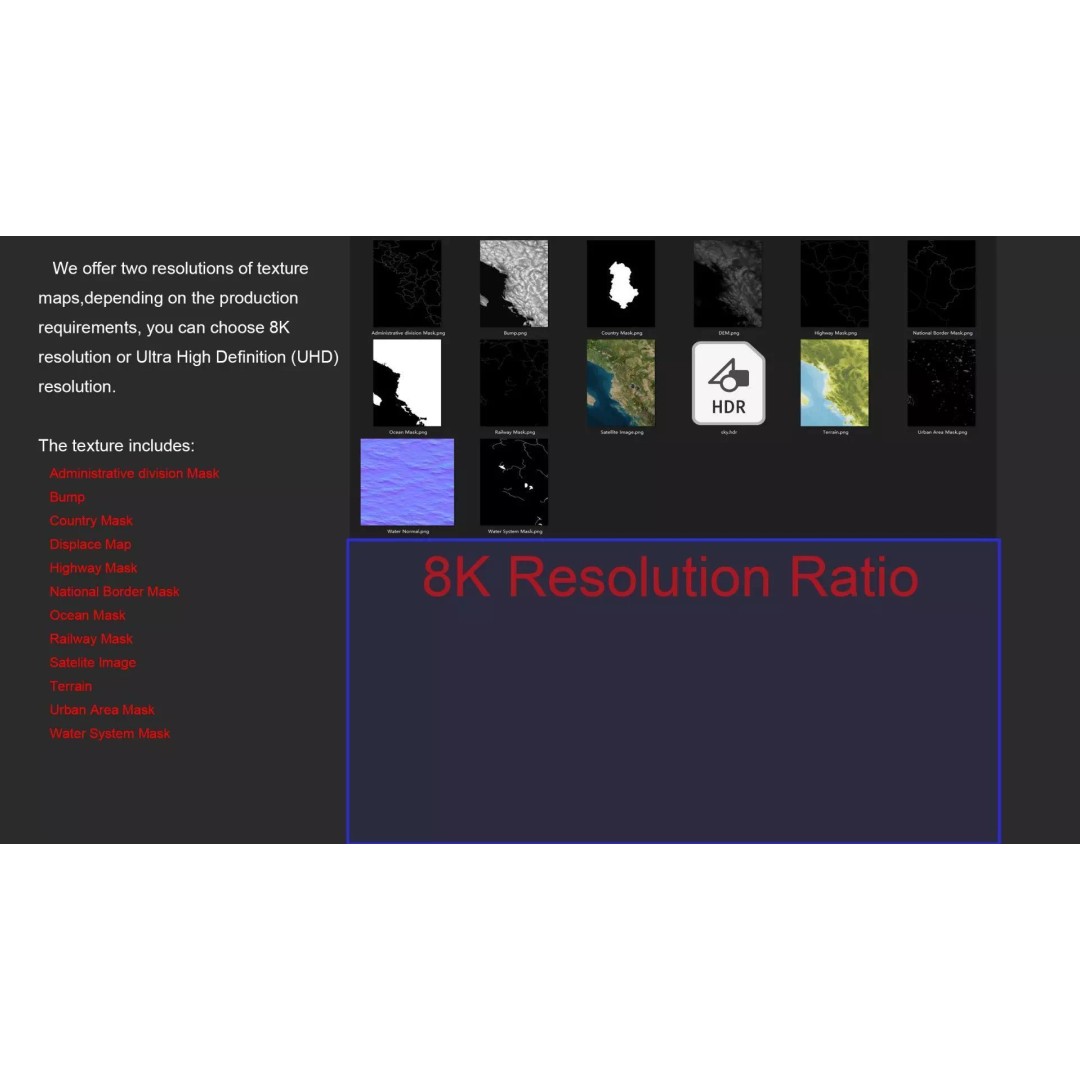
Features
3D Features
Geometry
Unwrapped UVs
Download information
After purchase, you will receive an email within several hours with a download link to access your files.
Description
Explore the stunningly detailed Albania Map 3D Model, featuring 8K realistic satellite terrain and high-accuracy elevation data. Perfect for geographic visualization, this model is designed for professionals in fields such as cartography, archviz, and game development.
The model showcases an intricate polygon mesh with a polygon count ranging from 720,000 to 11,520,000, ensuring exceptional detail and realism. With textures provided in 8K resolution, this asset includes satellite imagery and masks that enhance material blending, allowing for accurate representation of geographical features.
- Formats: MAX, FBX, OBJ, STL
- Polygons: 720,000 to 11,520,000
- Projection: Mercator GCS_WGS_1984
- Textures: 8K satellite imagery, DEM maps, and various masks for topographical features
- UV Mapping: Non-overlapping
- Materials: V-Ray materials converted for compatibility
This model is ideal for use in game engines such as Unity and Unreal Engine, as well as for architectural visualization and educational projects. With accurate national borders, water systems, and administrative divisions, it provides a comprehensive resource for any geographic or political analysis.
Download the Albania Map 3D Model today and elevate your projects with its rich details and textures. Get ready to enhance your visual storytelling!