Slovakia Map 3D Model – Realistic Satellite Terrain, 14K Textures
File Formats
Native Format
Exchange Formats
Features
3D Features
Geometry
Unwrapped UVs
Download information
After purchase, you will receive an email within several hours with a download link to access your files.
Description
Discover the stunning Slovakia Map 3D Model, featuring realistic satellite terrain with intricate elevation details. Perfect for enhancing your visual projects, this model provides a rich, immersive experience.
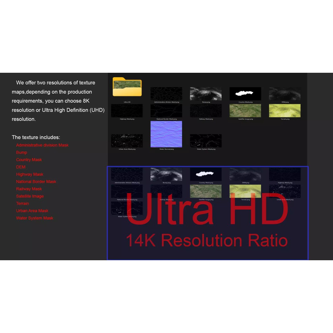
With high-resolution textures available in 8K and 14K, you’ll achieve breathtaking visuals for geographical representations or cartographic displays. The model includes satellite imagery and masks that allow for precise material blending, accurately depicting various terrains and elevations.
- Formats: MAX, FBX, OBJ, STL
- Polygons: 720,000 to 11,520,000
- Projection: Mercator GCS_WGS_1984
- UV Mapping: Non-overlapping
- High-resolution DEM (Displacement Map) for detailed surface tessellation
- Color Map generated with ≥ 30-meter accuracy
- Includes masks for national borders, administrative divisions, and urban areas
This model is ideal for game developers, architects, and visual effects artists looking to create realistic environments in their projects. Whether you’re working in Unity, Unreal Engine, or other 3D software, this asset is designed to meet your needs.
Download now and elevate your projects with this high-quality terrain model!