Belarus Map 3D Model – Realistic Satellite Terrain with PBR Textures
File Formats
Formats
Features
3D Features
Geometry
Unwrapped UVs
Download information
After purchase, you will receive an email within several hours with a download link to access your files.
Description
Discover the intricate details of Belarus with this realistic satellite terrain 3D model, perfect for various visualization projects.
Featuring high-resolution textures and accurate elevation data, this model is designed to enhance your geographical visualizations, making it ideal for educational purposes, game development, and architectural visualizations. With V-Ray materials and a polygon count ranging from 720,000 to 11,520,000, the asset ensures stunning visuals and a high level of detail.
- Formats: MAX, FBX, OBJ, STL
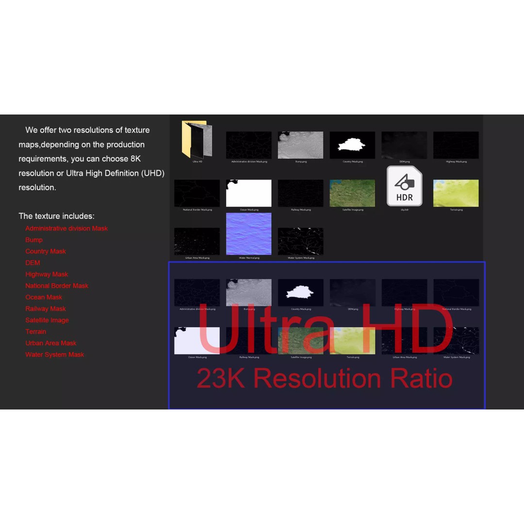
- Textures: High-resolution satellite imagery with Photoshop corrections
- Geometric Detail: Polygon mesh with non-overlapping UVs
- Displacement Map: Accurate DEM data with 30-meter precision
- Color Maps: Terrain representation with altitude differences
- Masking: National borders, water systems, and urban areas clearly defined
This model is perfect for professionals in mapping, education, and entertainment industries. Whether you're creating a game environment or a detailed geographical study, this asset will meet your needs with accuracy and style.
Ready for download, this model comes in multiple formats for easy integration into your projects. Get started today!