Eritrea Map 3D Model – Realistic Satellite Terrain, FBX & OBJ
File Formats
Native Format
Exchange Formats
Features
3D Features
Geometry
Unwrapped UVs
Download information
After purchase, you will receive an email within several hours with a download link to access your files.
Description
Discover the detailed Eritrea Map 3D Model, a stunning representation of realistic satellite terrain designed for various applications in geography and visualization.
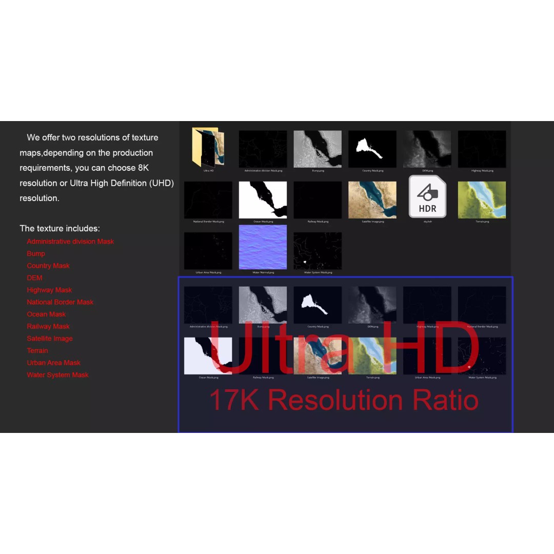
This high-quality model features an impressive polygon count ranging from 720,000 to 11,520,000, ensuring rich details and accurate geographic representation. With textures provided in both 8K and 17K resolutions, your projects will benefit from exceptional visual fidelity. The model is meticulously crafted using Autodesk 3ds Max and rendered with V-Ray, providing a professional finish for your visualizations.
- Formats: MAX, FBX, OBJ, STL
- Polygon Count: 720,000 - 11,520,000
- Model Size: 1000 M x 833 M
- Projection: Mercator GCS_WGS_1984
- Textures: Satellite imagery, DEM, Bump maps, Color maps
- Features: Unwrapped UVs, Non-overlapping UVs, National and Administrative division masks
This 3D model is perfect for game developers, cartographers, educators, and researchers who require accurate terrain visualization for projects. The inclusion of administrative and national borders, water systems, and urban areas enhances its usability across various domains.
Ready to enhance your projects with this premium model? Download now to access multiple formats and elevate your visual storytelling!