Kenya Map 3D Model – Realistic Satellite Terrain, 23K Textures
File Formats
Native Format
Exchange Formats
Features
3D Features
Geometry
Unwrapped UVs
Download information
After purchase, you will receive an email within several hours with a download link to access your files.
Description
Discover the stunning realism of our Kenya Map 3D Model, featuring high-resolution satellite terrain ideal for geographic visualization and cartographic projects.
This meticulously crafted 3D model includes detailed textures and maps, providing a rich visual representation of Kenya's topography. With a polygon count ranging from 720,000 to 11,520,000, this model ensures high fidelity in every detail, making it perfect for professional applications.
- Formats: MAX, FBX, OBJ, STL
- Polygons: 720,000 - 11,520,000
- Size: 875 m x 1000 m
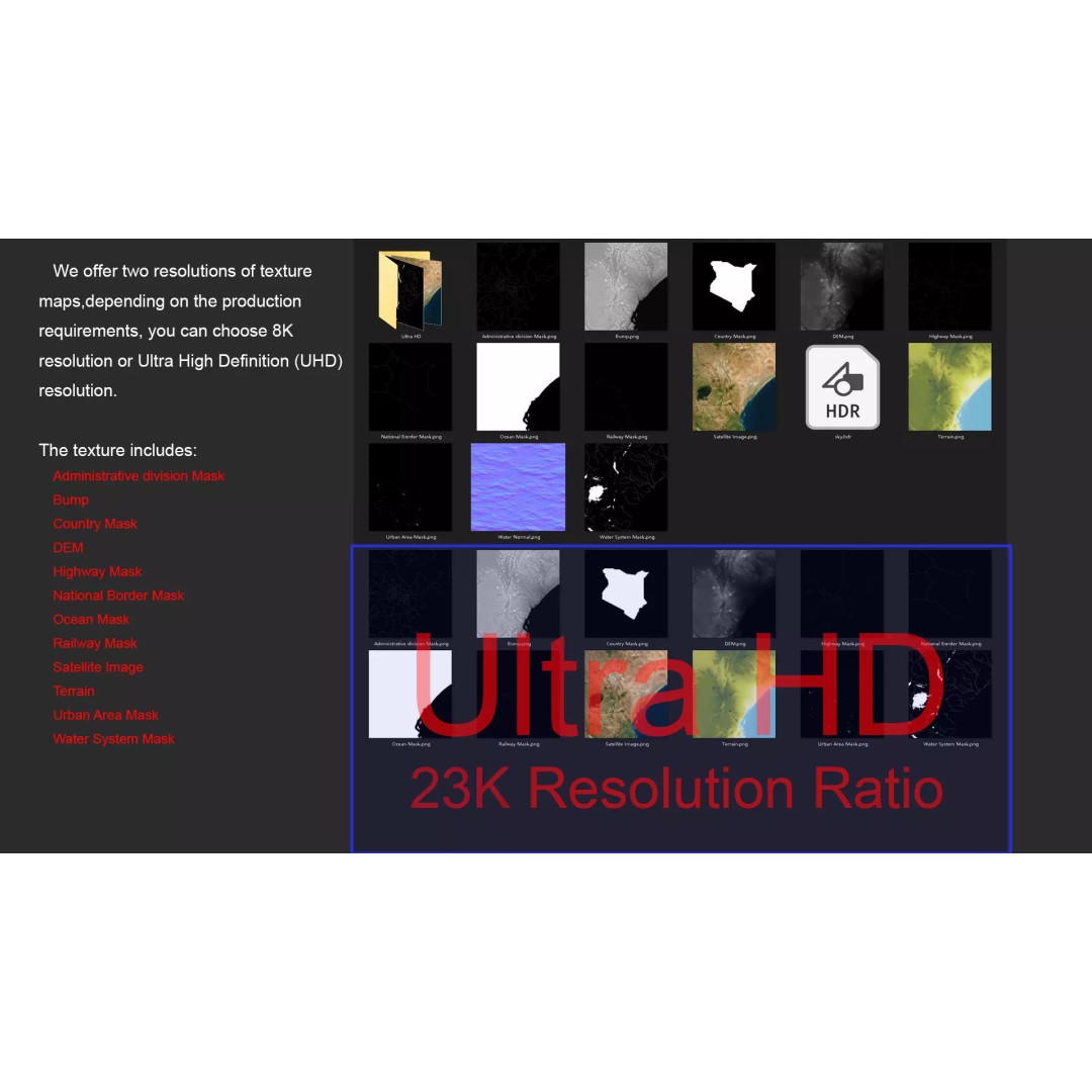
- Textures: Available in 8K and 23K resolutions
- DEM (Displacement Map): ≥ 30-meter accuracy
- UV Mapping: Non-overlapping
This 3D model is perfect for various use cases, including game development, architectural visualization, and educational purposes. The realistic textures and elevation data allow for enhanced immersion and accurate representation of the Kenyan landscape.
Download now and elevate your projects with this premium terrain model, available in multiple formats for versatile use.