Uruguay Map 3D Model – Realistic Satellite Terrain, FBX & OBJ
File Formats
Native Format
Exchange Formats
Features
3D Features
Geometry
Unwrapped UVs
Download information
After purchase, you will receive an email within several hours with a download link to access your files.
Description
Explore the stunning details of the Uruguay Map 3D Model, featuring a realistic satellite terrain representation that is perfect for geographical visualizations. This high-quality model is designed to elevate your projects with its comprehensive features and accuracy.
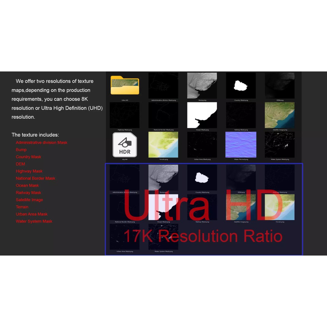
With polygon counts ranging from 720,000 to 11,520,000, this model ensures a rich and detailed presentation of Uruguay's varied landscapes. The textures include beautiful satellite imagery and masks that enhance material blending based on geographical data, available in both 8K and 17K resolutions. The Displacement Map (DEM) offers a precise elevation representation, generated with a minimum accuracy of 30 meters, allowing for stunning visual effects in your projects.
- Format: MAX, FBX, OBJ, STL
- Native: 3ds Max with V-Ray materials
- Polygons: 720,000 – 11,520,000
- Model Size: 958 m x 1000 m
- Projection: Mercator GCS_WGS_1984
- Textures: 8K and 17K satellite imagery, DEM, bump maps, and various masks for terrain features
- UV Mapping: Non-overlapping UVs
This model is ideal for game developers, architects, and visualization professionals looking to create immersive environments that accurately reflect the geography of Uruguay. Its versatility makes it suitable for use in various software applications, including Unity and Unreal Engine, although some adjustments to materials may be necessary when importing into different platforms.
Download now to enhance your projects with this detailed Uruguay Map 3D Model, available in multiple formats!