Italy Map 3D Model – Realistic Satellite Terrain, FBX & OBJ Formats
File Formats
Native Format
Exchange Formats
Features
3D Features
Geometry
Unwrapped UVs
Download information
After purchase, you will receive an email within several hours with a download link to access your files.
Description
Explore the intricate details of Italy with this realistic satellite terrain 3D model. Designed for professionals in visualization, this asset offers an authentic representation of Italy's diverse geography.
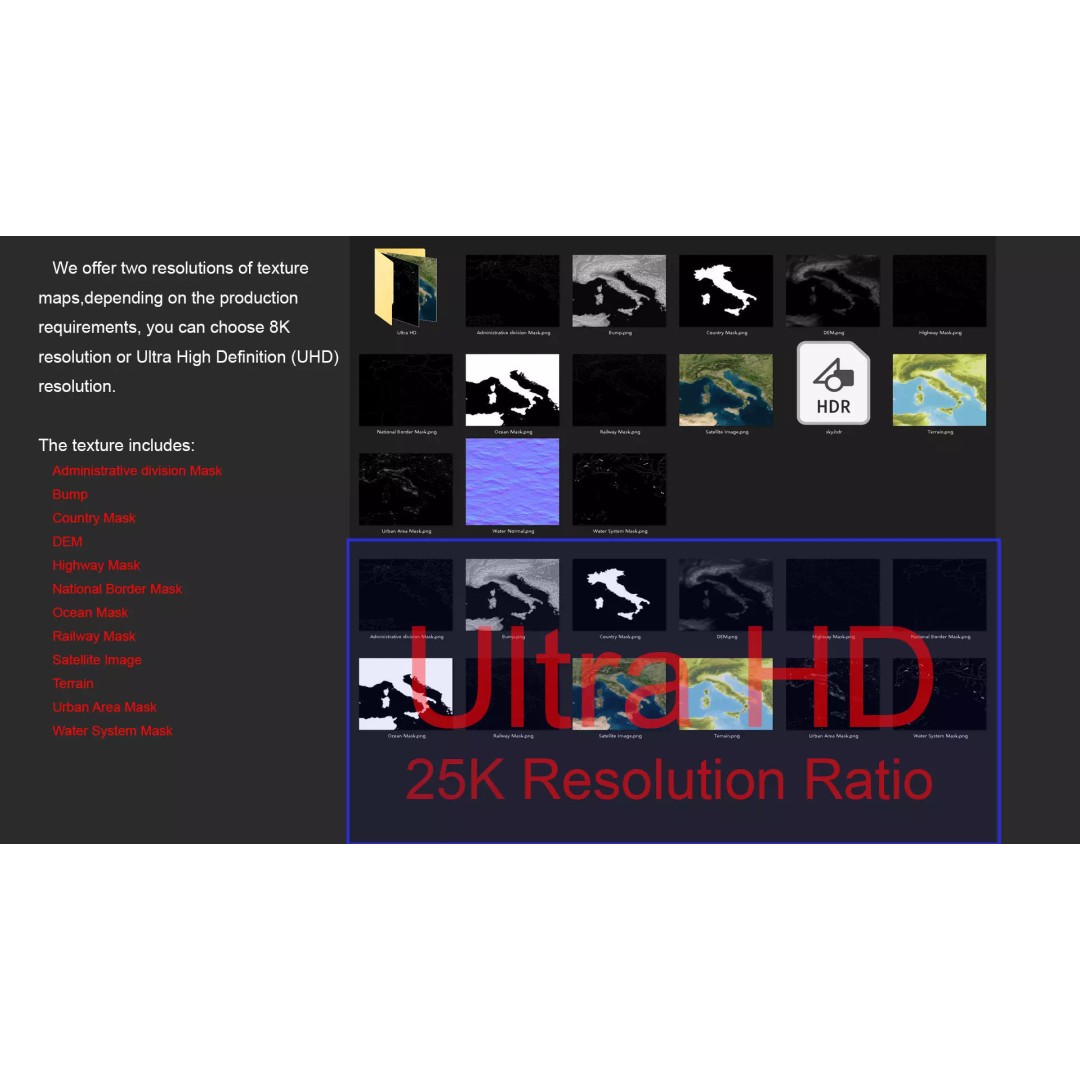
Featuring high-resolution satellite imagery and an array of texture maps, this model allows for stunning visual accuracy. The model comes equipped with DEM (Displacement Map) and bump maps, ensuring rich surface details that reflect the altitude and height variations across the terrain. With options for both 8K and 25K textures, this asset is perfect for projects requiring high-quality visuals.
- Formats: MAX, FBX, OBJ, STL
- Polygons: 720,000 to 11,520,000
- Projection: Mercator GCS_WGS_1984
- Unwrapped UVs: Non-overlapping
- Resolution: 25K satellite imagery with Photoshop corrections
- Features: National borders, country masks, administrative divisions, and water systems
This model is ideal for game developers, architects, and animators looking to enhance their projects with accurate geographical representation. Its versatile formats make it compatible with various 3D software, ensuring seamless integration into your workflow.
Download now to elevate your project with this comprehensive Italy map 3D model!