Hungary Map 3D Model – Realistic Satellite Terrain, 15K Textures
File Formats
Native Format
Exchange Formats
Features
3D Features
Geometry
Unwrapped UVs
Download information
After purchase, you will receive an email within several hours with a download link to access your files.
Description
Discover the stunning Hungary Map 3D Model, featuring highly detailed realistic satellite terrain rendered in exceptional 15K resolution. This asset is perfect for geographic visualization and cartography applications, showcasing the intricate details of Hungary’s landscape.
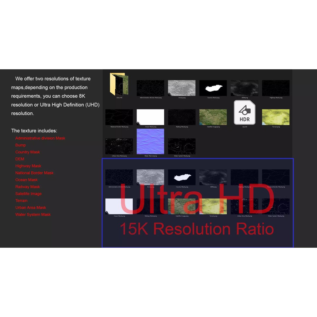
Our model includes high-resolution satellite imagery and a comprehensive set of masks designed for material blending. These masks facilitate the adjustment of material representation based on geographical data, ensuring your visualizations are both accurate and visually appealing. The terrain color map visually represents altitude variations, while the DEM (Displacement Map) enhances model displacement with precision.
- Formats: MAX, FBX, OBJ, STL
- Polygons: 720,000 - 11,520,000
- Native: 3ds Max with V-Ray materials
- Resolution: Textures available in 8K and 15K
- Unwrapped UVs: Non-overlapping
This model is ideally suited for use in game development, architectural visualization, educational projects, and more. Whether you are creating immersive environments or detailed presentations, this Hungary terrain model will elevate your project.
Ready to enhance your project? Download now and explore the detailed landscapes of Hungary!