Ukraine Map 3D Model – Realistic Satellite Terrain, FBX, OBJ
File Formats
Native Format
Exchange Formats
Features
3D Features
Geometry
Unwrapped UVs
Download information
After purchase, you will receive an email within several hours with a download link to access your files.
Description
Discover the stunning Ukraine Map 3D Model, featuring a highly detailed realistic satellite terrain ideal for various applications. With breathtaking elevation data and rich textures, this model is perfect for cartography, visualization, and gaming.
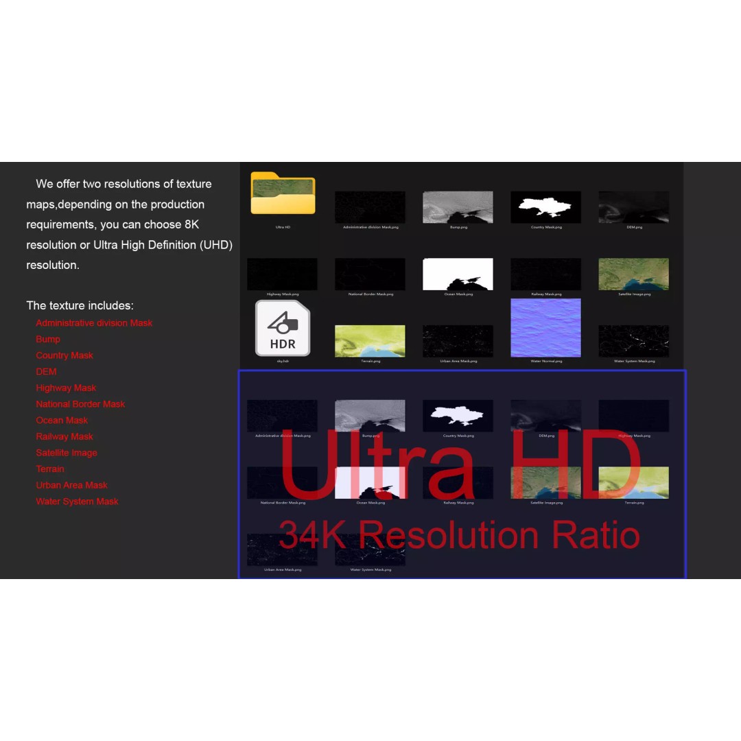
Crafted with precision, this model includes high-resolution satellite imagery and masks that enhance material blending based on geographical data. The textures are available in both 8K and 34K resolutions, ensuring a true-to-life representation of Ukraine's diverse landscapes. Each texture map is generated from elevation data with an accuracy of ≥ 30 meters, providing stunning surface details and depth.
- Format: MAX, FBX, OBJ, STL
- Polygons: 720000-11520000
- Model Size: 1000 m x 541 m
- Projection: Mercator GCS_WGS_1984
- Textures: Satellite imagery, DEM, Bump, Terrain Color Map
- Includes masks for national borders, water systems, highways, and urban areas
- Unwrapped UVs: Non-overlapping
This asset is perfect for game developers, architects, and 3D artists looking to create realistic environments or visualizations. Whether you’re designing a game scene, a simulation, or an educational tool, this model will elevate your project.
Download this Ukraine Map 3D Model now and bring authenticity to your creations with its detailed textures and versatile formats.