Tajikistan Map 3D Model – Realistic Satellite Terrain, 18K Textures
File Formats
Native Format
Exchange Formats
Features
3D Features
Geometry
Unwrapped UVs
Download information
After purchase, you will receive an email within several hours with a download link to access your files.
Description
Discover the stunning Tajikistan Map 3D Model, featuring highly detailed realistic satellite terrain and elevation data, perfect for your geographical visualizations.
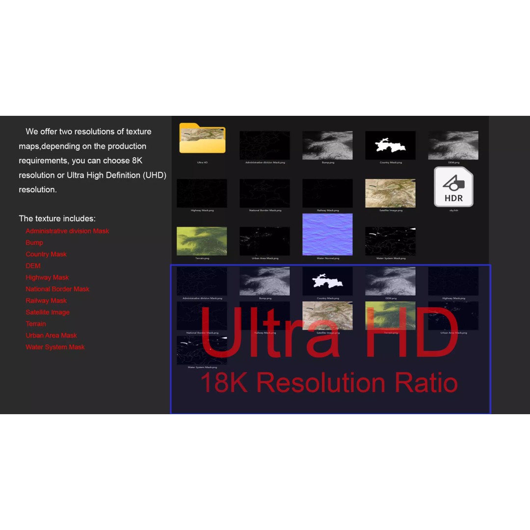
This model is crafted with precision, providing a rich representation of Tajikistan's unique topography. With textures available in both 8K and 18K resolutions, you can achieve realistic material blending and accurate geographical representation. The model incorporates satellite imagery corrected for cloud cover, ensuring clarity and detail.
- Formats: MAX, FBX, OBJ, STL
- Polygon Count: 720,000 to 11,520,000
- Projection: Mercator GCS_WGS_1984
- Textures: Includes color maps, bump maps, and displacement maps generated from elevation data with ≥ 30-meter accuracy
- UV Mapping: Non-overlapping UVs for seamless texturing
This 3D model is ideal for game developers, architects, and educators who require a high-fidelity representation of Tajikistan for projects in 3D software like Autodesk 3ds Max or other platforms. Enhance your visual storytelling with this comprehensive geographical asset.
Download now and elevate your projects with this detailed Tajikistan Map 3D Model, available in multiple formats!