Algeria Map 3D Model – Realistic Satellite Terrain, 38K Textures
File Formats
Native Format
Exchange Formats
Features
3D Features
Geometry
Unwrapped UVs
Download information
After purchase, you will receive an email within several hours with a download link to access your files.
Description
Explore the stunning realism of the Algeria Map 3D Model, featuring high-resolution satellite terrain with meticulous detail. This model is perfect for anyone looking to visualize geographical data accurately.
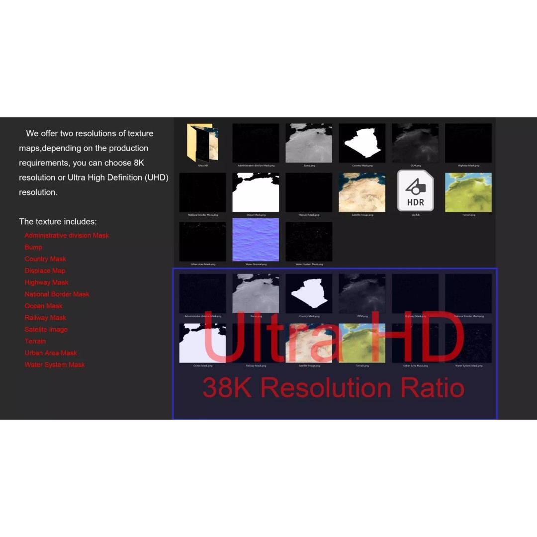
With a polygon count ranging from 720,000 to 11,520,000, this model provides exceptional detail, making it suitable for various applications from gaming to architectural visualization. The provided textures include both 8K and 38K resolutions, ensuring high-quality representation of the terrain.
- Formats: MAX, FBX, OBJ, STL
- Native: 3ds Max with V-Ray materials
- Polygon Count: 720,000-11,520,000
- Model Size: 1000 m x 905 m
- Projection: Mercator GCS_WGS_1984
- Rich Textures: Satellite imagery and masks included
- Unwrapped UVs: Non-overlapping
This model is ideal for game developers, architects, and educators looking to incorporate realistic geographical representations in their projects. Its detailed elevation data and various masks allow for versatile use in different contexts.
Download now to elevate your projects with this comprehensive geographical asset.