Western Sahara Map 3D Model – Realistic Satellite Terrain, FBX, OBJ
File Formats
Native Format
Exchange Formats
Features
3D Features
Unwrapped UVs
Download information
After purchase, you will receive an email within several hours with a download link to access your files.
Description
Explore the stunning detail of the Western Sahara with this realistic satellite terrain 3D model. Perfect for geographical visualization and cartographic projects, this model offers a high level of accuracy and detail.
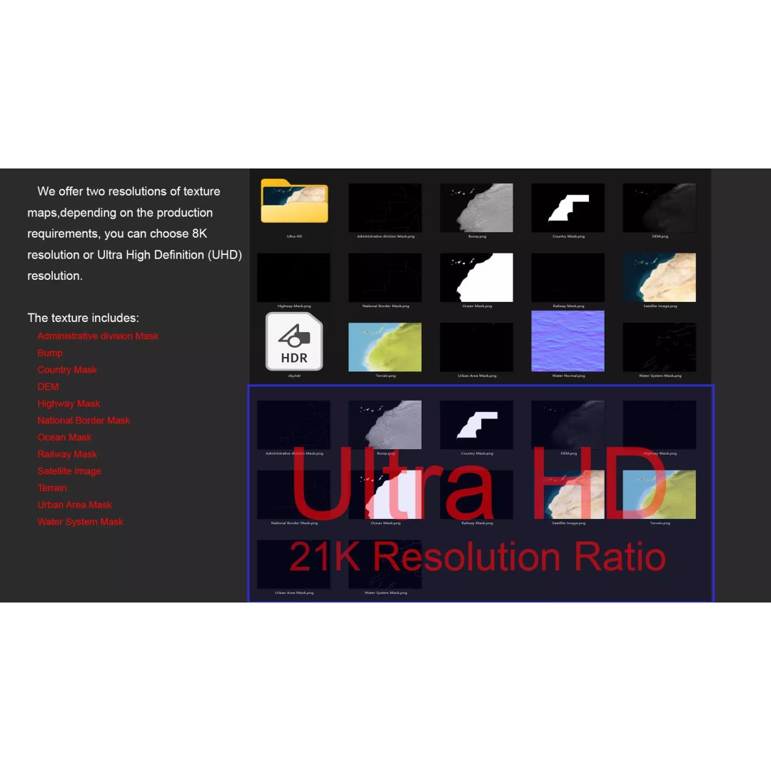
With a polygon count ranging from 720,000 to 11,520,000, this terrain model provides an immersive experience for users in various fields. The model features 21K textures, allowing for vibrant and realistic representations of the landscape, complete with satellite imagery and elevation data corrected for cloud cover.
- Formats: MAX, FBX, OBJ, STL
- Native Software: Autodesk 3ds Max with V-Ray materials
- Polygon Count: 720,000 – 11,520,000
- Model Size: 1000 M x 800 M
- Textures: Includes 8K and 21K resolution textures
- Displacement Maps: Accurate elevation data with ≥ 30-meter precision
- Color Maps: Visual representation of altitude differences
- National and Administrative Borders: Clearly marked for geographical context
This model is ideal for game developers, architects, and visual artists looking to incorporate detailed terrain into their projects. Whether for educational purposes, simulations, or artistic endeavors, the Western Sahara Map is a versatile asset.
Download now to enhance your project with this exceptional 3D terrain model.