Peru Map 3D Model – Realistic Satellite Terrain with Elevation Data, FBX, OBJ
File Formats
Native Format
Exchange Formats
Features
3D Features
Geometry
Unwrapped UVs
Download information
After purchase, you will receive an email within several hours with a download link to access your files.
Description
Explore the breathtaking landscapes of Peru with this highly detailed Peru Map 3D Model. Featuring realistic satellite terrain and elevation data, this asset is perfect for geographical visualizations, educational projects, and immersive simulations.
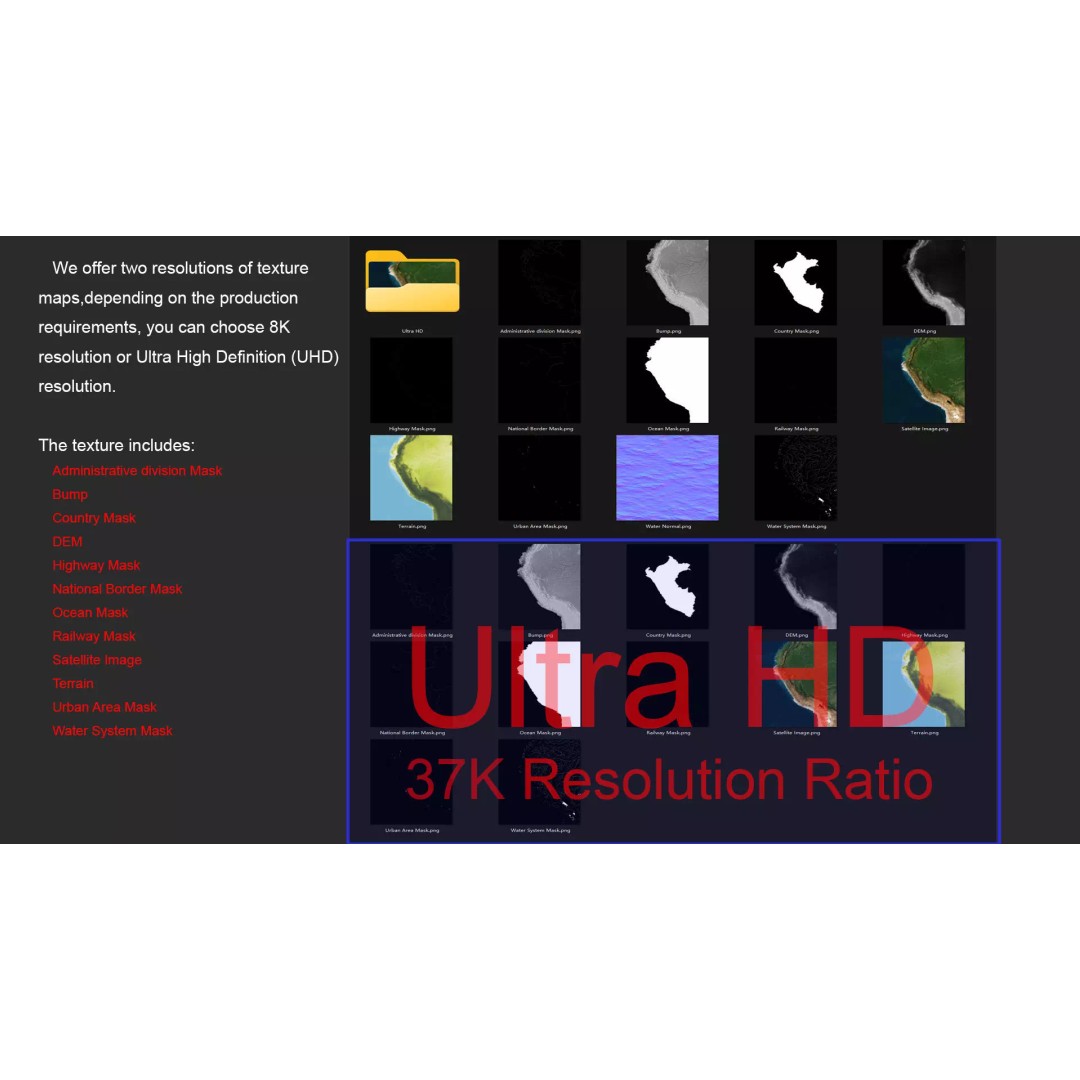
This 3D model is designed with precision, utilizing high-resolution satellite imagery and advanced displacement maps to create an authentic representation of the terrain. With textures available in both 8K and 37K resolutions, you can achieve stunning visual fidelity in your projects.
- File Formats: MAX, FBX, OBJ, STL
- Polygon Count: 720,000 to 11,520,000
- Projection: Mercator GCS_WGS_1984
- Includes detailed DEM (Displacement Map) for accurate terrain representation
- Rich surface details with bump maps generated from elevation data
- National borders and administrative divisions clearly marked
This 3D model is ideal for game developers, architects, and educators seeking to incorporate realistic geographical features into their work. Perfect for use in Unity, Unreal Engine, or any 3D modeling software.
Download now to elevate your projects with this exceptional Peru Map 3D Model!