Senegal Map 3D Model – Realistic Satellite Terrain, FBX, OBJ
File Formats
Native Format
Exchange Formats
Features
3D Features
Geometry
Unwrapped UVs
Download information
After purchase, you will receive an email within several hours with a download link to access your files.
Description
Discover the stunning realism of the Senegal Map 3D Model, featuring high-quality satellite terrain and elevation data. Perfect for visualization and geographical representation, this model brings the rich details of Senegal to life.
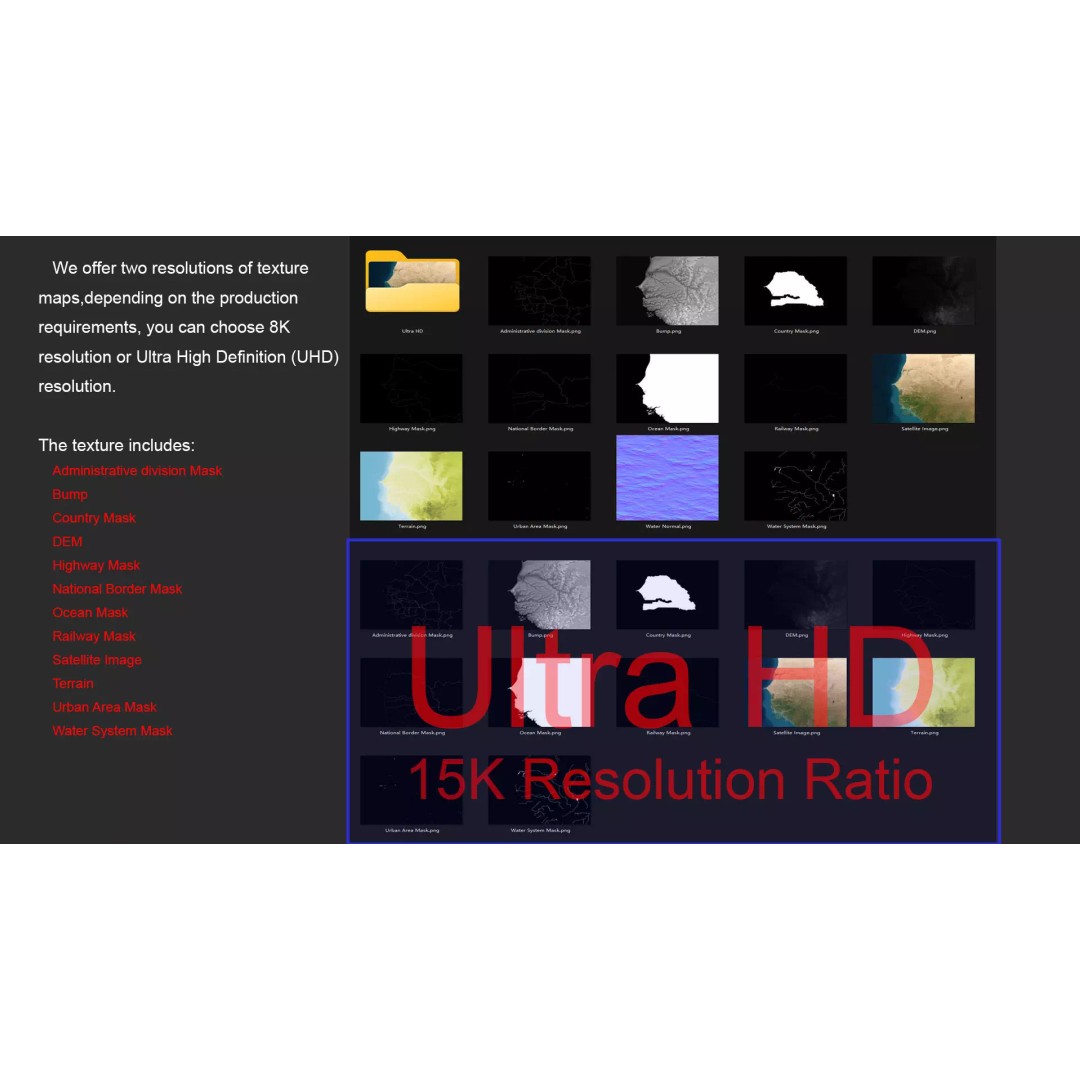
Crafted with precision, the model includes textures and masks derived from high-resolution satellite imagery. With options in both 8K and 15K resolutions, it ensures that your projects retain clarity and detail. The terrain features vibrant color maps that represent altitude and height differences, providing a visually engaging experience.
- Formats: MAX, FBX, OBJ, STL
- Polygon Count: 720000–11520000
- Projection: Mercator GCS_WGS_1984
- Textures: Includes satellite imagery, DEM, bump, and color maps
- UV Mapping: Non-overlapping
- Administrative and national masks included
This model is ideal for game developers, architects, and anyone involved in animation and visualization projects. Whether you’re creating a geographical simulation or enhancing an educational platform, this asset is a valuable addition.
Download now and bring realistic terrain to your designs!