Eswatini Map 3D Model – Realistic Satellite Terrain with Textures, FBX, OBJ
File Formats
Native Format
Exchange Formats
Features
Geometry
3D Features
Unwrapped UVs
Download information
After purchase, you will receive an email within several hours with a download link to access your files.
Description
Explore the intricate details of the Eswatini Map 3D Model, a realistic satellite terrain that showcases the stunning geography of this beautiful region. Perfect for visualization projects, this model combines high-quality textures with accurate elevation data.
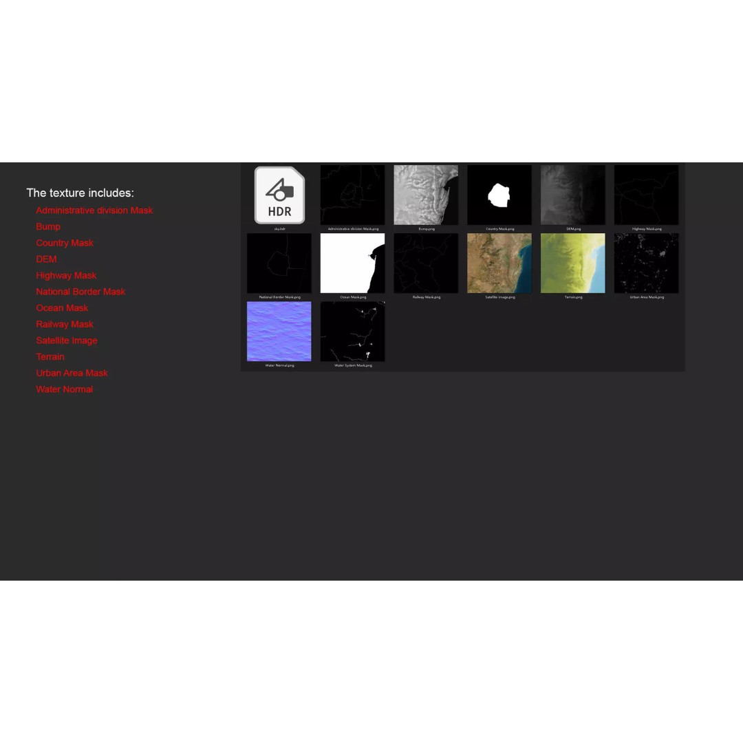
This 3D model comes with comprehensive features, including 5K resolution textures and precise displacement maps derived from elevation data with ≥ 30-meter accuracy. The model includes masks for national borders, urban areas, water systems, and more, allowing for rich material blending and geographical representation.
- Formats: MAX, FBX, OBJ, STL
- Polygon Count: 720,000 to 11,520,000
- Model Size: 1000 m x 1000 m
- Projection: Mercator GCS_WGS_1984
- High-resolution satellite imagery with PS correction
- Includes DEM and bump maps for detailed surface representation
- Unwrapped UVs: Non-overlapping
This model is ideal for game developers, architects, and educators looking to incorporate realistic geographical representations into their projects. Whether for urban planning, education, or virtual simulations, this Eswatini map will enhance your visual storytelling.
Download now and start visualizing with our versatile file formats!