Colombia Map 3D Model – Realistic Satellite Terrain, FBX, OBJ
File Formats
Native Format
Exchange Formats
Features
3D Features
Geometry
Unwrapped UVs
Download information
After purchase, you will receive an email within several hours with a download link to access your files.
Description
Explore the stunning Colombia Map 3D Model, a highly detailed realistic satellite terrain asset designed for a variety of applications. This model features exceptional elevation data and rich textures, perfect for visualizing geographical landscapes.
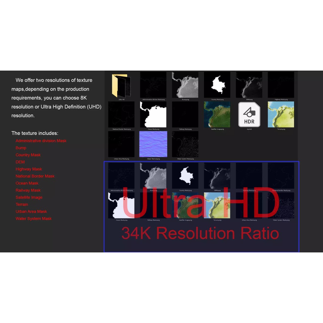
Crafted using advanced modeling techniques, this 3D model includes satellite imagery and masks that enhance material blending based on geographical data. With resolutions available in both 8K and 34K, your projects will benefit from high-quality visuals and accurate representations. The model is created in Autodesk 3ds Max and rendered with V-Ray, ensuring professional-grade output.
- Formats: MAX, FBX, OBJ, STL
- Polygons: 720,000 to 11,520,000
- Projection: Mercator GCS_WGS_1984
- Textures: Satellite imagery, DEM, bump maps
- Unwrapped UVs: Non-overlapping
- Features: National borders, country masks, administrative divisions, water systems, railways, highways, urban areas
This model is ideal for game development, architectural visualization, and educational projects, providing a realistic representation of Colombia's diverse landscapes. Whether you are an artist, developer, or educator, this asset offers endless possibilities for your creative needs.
Download this Colombia Map 3D Model today and elevate your projects with stunning geographical detail!