Iraq Map 3D Model – Realistic Satellite Terrain, 22K Textures, FBX, OBJ
File Formats
Native Format
Exchange Formats
Features
3D Features
Geometry
Unwrapped UVs
Download information
After purchase, you will receive an email within several hours with a download link to access your files.
Description
Discover the stunning realism of the Iraq Map 3D Model, crafted with high-quality satellite imagery and detailed elevation data. This model is perfect for visualizing geographical data with accuracy and depth.
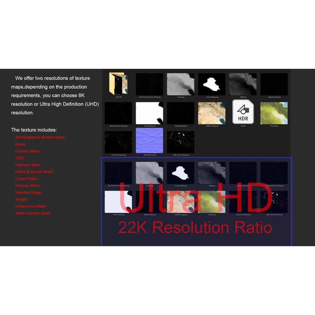
Featuring a comprehensive range of textures and materials, the model includes 22K resolution satellite images, allowing for exceptional detail in your projects. The elevation data is meticulously processed to provide ≥ 30-meter accuracy, ensuring that the terrain's characteristics are well-represented. With multiple projection maps, including national borders and administrative divisions, your visualizations will convey precise geographical information.
- Formats: MAX, FBX, OBJ, STL
- Polygons: 720,000 to 11,520,000
- High-resolution textures: 8K and 22K available
- Includes DEM and displacement maps for enhanced realism
- V-Ray materials for Autodesk 3ds Max
- Compatible with various 3D applications (material adjustments may be required)
This model is ideal for game developers, architects, and researchers who require accurate terrain visualization in their projects. Whether you're developing a game, creating animations, or designing architectural visualizations, this terrain model serves as a versatile asset.
Ready to elevate your projects? Download now and explore the possibilities!