Vietnam Map 3D Model – Realistic Terrain with Satellite Imagery, FBX/OBJ
File Formats
Native Format
Exchange Formats
Features
3D Features
Geometry
Unwrapped UVs
Download information
After purchase, you will receive an email within several hours with a download link to access your files.
Description
Discover the stunning Vietnam Map 3D Model, featuring a realistic terrain representation created from high-resolution satellite imagery. Perfect for geographical visualization and cartography projects.
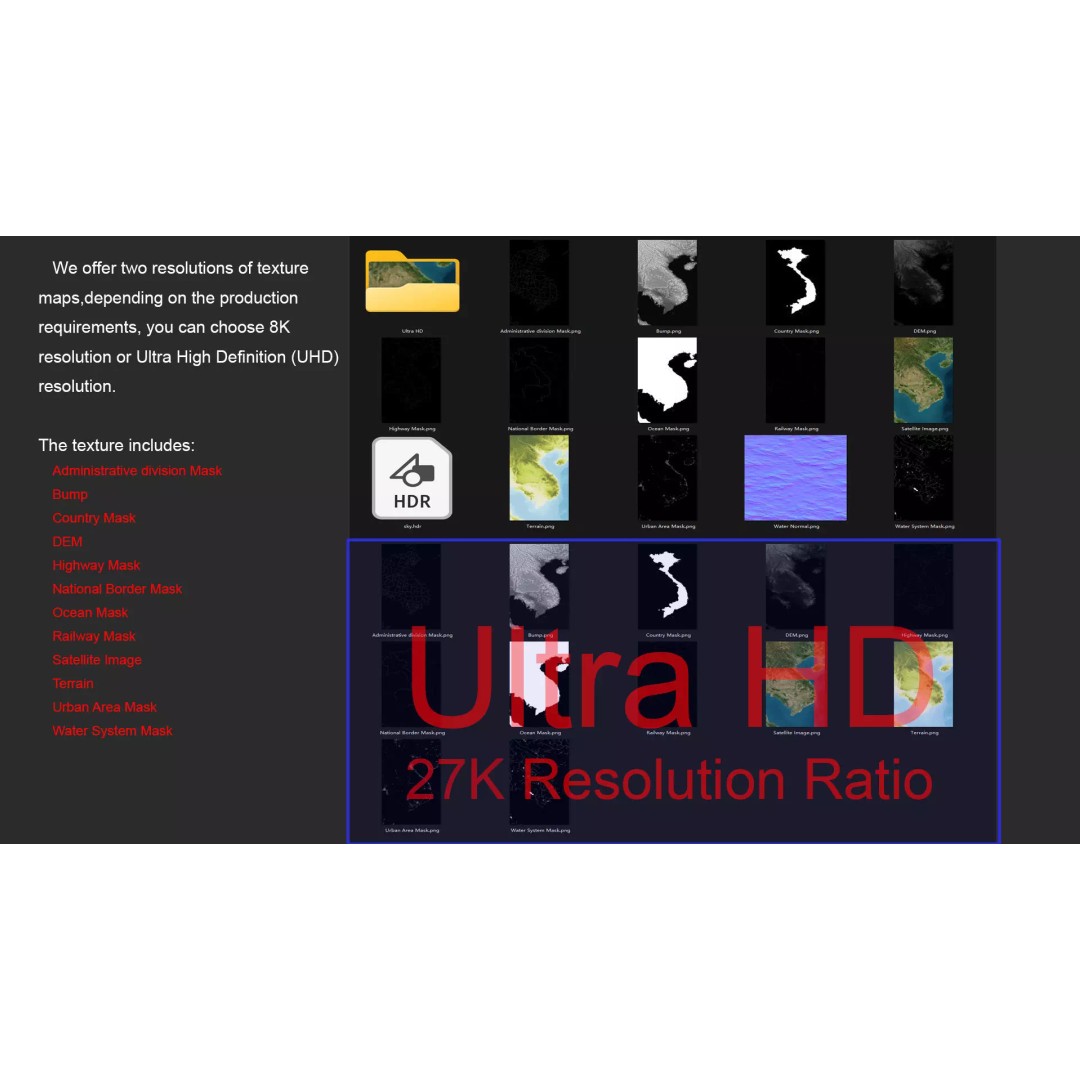
This model is designed with meticulous attention to detail, boasting a polygon count ranging from 720,000 to 11,520,000, ensuring a high level of realism. The terrain is enhanced with 27K resolution textures, providing exceptional clarity and depth, making it ideal for applications in animation, game development, and architectural visualization.
- Formats: MAX, FBX, OBJ, STL
- Native: Autodesk 3ds Max with V-Ray materials
- Polygon Count: 720,000 - 11,520,000
- High-Resolution Textures: Available in 8K and 27K
- DEM (Displacement Map): Accurate to ≥ 30 meters
- Bump and Color Maps: Generated from elevation data
- UV Mapping: Non-overlapping for easy texturing
This Vietnam Map is perfect for developers, animators, and educators looking to visualize geographic data or create immersive environments. Its extensive features allow for a versatile range of uses, from gaming assets to engaging educational tools.
Ready to enhance your projects? Download now and explore the detailed features!