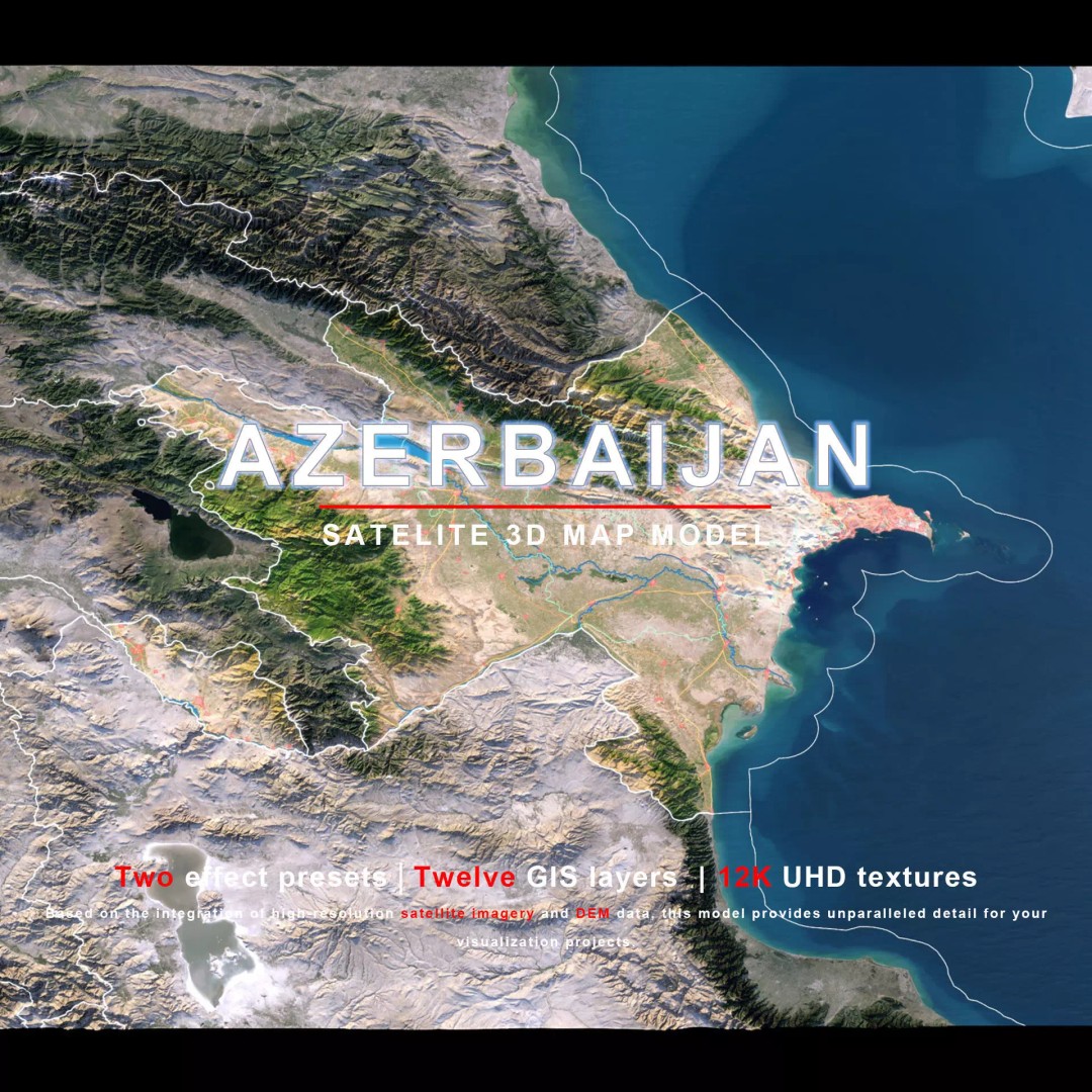
Azerbaijan Map 3D Model – Realistic Satellite Terrain, 12K Textures
File Formats
Native Format
Exchange Formats
Features
3D Features
Geometry
Unwrapped UVs
Download information
After purchase, you will receive an email within several hours with a download link to access your files.
Description
Discover the stunning Azerbaijan Map 3D Model, a highly detailed and realistic satellite terrain asset perfect for a variety of applications. With breathtaking 12K textures and intricate elevation data, this model brings geographical visualization to life.
Crafted with precision, this model features high-resolution satellite imagery and masks that enhance material blending and representation based on geographical data. The terrain includes a color map generated from elevation data, ensuring accurate altitude visualizations. The model is designed for versatility, providing options for both gaming and architectural visualizations.
- Formats: MAX, FBX, OBJ, STL
- Native: MAX VRAY
- Polygon Count: 720,000 to 11,520,000
- Projection: Mercator GCS_WGS_1984
- Textures: Available in 8K and 12K resolutions
- DEM and Bump Maps for realistic surface details
- Non-overlapping UV Mapping for optimal compatibility
This model is ideal for game developers, architects, and anyone looking to create immersive environments or detailed geographical representations. Its high level of detail makes it suitable for both high-end visualizations and interactive applications.
Download now to access this incredible Azerbaijan Map 3D Model and elevate your project!