Indonesia Map 3D Model – Realistic Satellite Terrain, FBX & OBJ
File Formats
Native Format
Exchange Formats
Features
3D Features
Geometry
Unwrapped UVs
Download information
After purchase, you will receive an email within several hours with a download link to access your files.
Description
Discover the stunning Indonesia Map 3D Model, an incredibly detailed realistic satellite terrain asset perfect for your projects. This high-resolution model captures the intricate features of Indonesia's landscape, making it an essential tool for visualization and geographic studies.
With a polygon count ranging from 720,000 to 11,520,000, this model provides a rich and immersive experience. The inclusion of 8K and 40K texture maps enhances the visual fidelity, ensuring that your representations of Indonesia are both accurate and engaging. The model employs advanced material blending techniques using satellite imagery and masks, allowing for realistic material representation across diverse geographical data.
- Formats: MAX, FBX, OBJ, STL
- Polygon Count: 720,000 – 11,520,000
- Model Size: 1000 M x 432 M
- Projection: Mercator GCS_WGS_1984
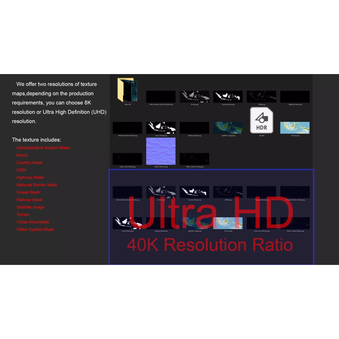
- Textures: Available in 8K and 40K resolutions
- Includes DEM, Bump, and Color Maps for enhanced surface detail
- National, Country, and Administrative Division Masks included
- Unwrapped UVs: Non-overlapping
This model is ideal for artists, game developers, and educators looking to create realistic geographic visualizations or animations. Whether you’re developing a game, conducting research, or producing educational content, the Indonesia Map 3D Model will elevate your work.
Download now and bring the geography of Indonesia to life in your projects!