Belgium Map 3D Model – Realistic Terrain Elevation with Satellite Imagery
File Formats
Native Format
Exchange Formats
Features
3D Features
Geometry
Unwrapped UVs
Download information
After purchase, you will receive an email within several hours with a download link to access your files.
Description
Explore the intricate details of Belgium with our high-quality 3D model, showcasing realistic terrain elevation and satellite imagery. This Belgium Map 3D Model is perfect for visualization projects, enhancing your geographical presentations and simulations.
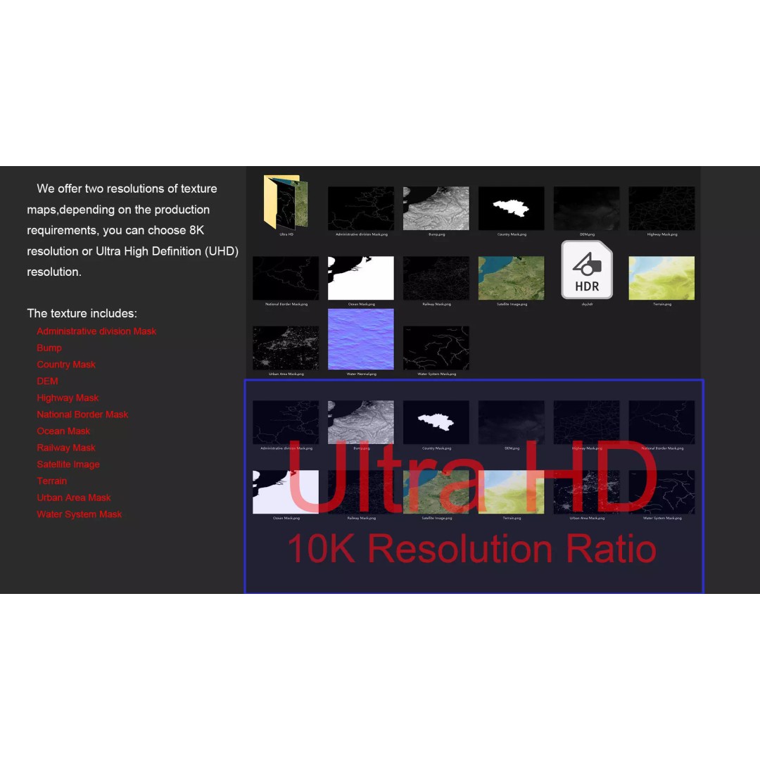
Crafted with precision, this model features a polygon mesh with a range of 720,000 to 11,520,000 polygons, ensuring a detailed representation of Belgium's topography. The model includes textures in both 8K and 10K resolutions, providing stunning visual fidelity. The elevation data, generated with a minimum accuracy of 30 meters, enhances the model's realism, making it ideal for applications in cartography, educational tools, and more.
- Formats: MAX, FBX, OBJ, STL
- Polygons: 720,000 - 11,520,000
- Texture Resolutions: 8K and 10K
- Projection: Mercator GCS_WGS_1984
- Includes: Satellite imagery, DEM, bump maps, and various geographical masks
- Unwrapped UVs: Non-overlapping
This asset is designed for use in a variety of applications, including game development, architectural visualizations, and animations. Whether you are a developer, educator, or artist, this model provides a rich resource to bring your projects to life.
Download now to enhance your visualizations with this detailed Belgium Map 3D Model, available in multiple formats!