Yemen Map 3D Model – Realistic Satellite Terrain, MAX, FBX, OBJ
File Formats
Native Format
Exchange Formats
Features
3D Features
Geometry
Unwrapped UVs
Download information
After purchase, you will receive an email within several hours with a download link to access your files.
Description
Explore the stunning Yemen Map 3D Model, featuring highly detailed satellite terrain designed for realistic visualizations. This model is perfect for geographical analysis, cartography, and educational purposes.
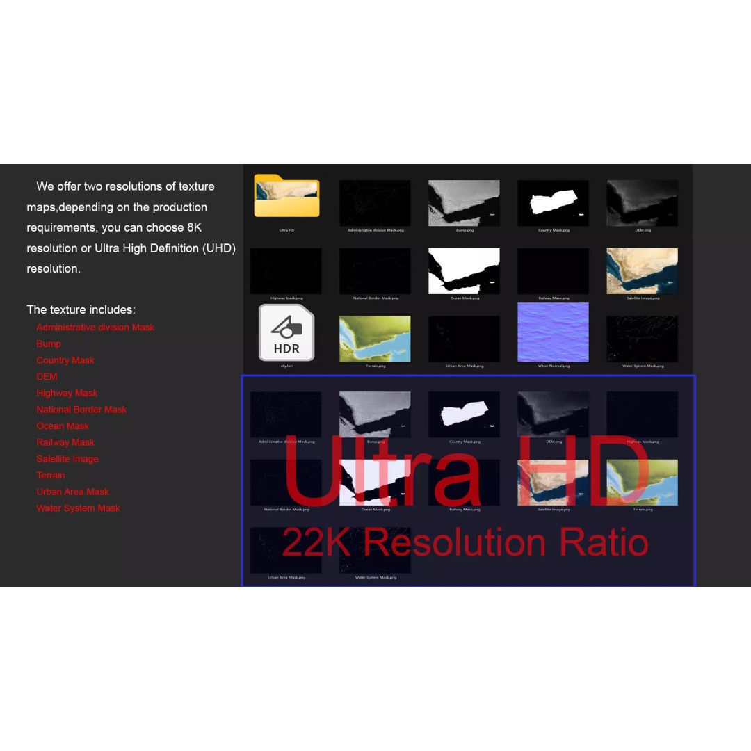
Crafted with precision, this 3D model includes a rich array of textures and materials, ensuring a lifelike representation of Yemen's diverse landscapes. With resolutions up to 22K, the satellite imagery provides exceptional clarity, making it ideal for high-quality projects.
- Formats: MAX, FBX, OBJ, STL
- Polygons: 720,000 to 11,520,000
- Texture Resolution: 8K and 22K available
- DEM: Displacement Map for realistic terrain elevation
- Bump Maps: Elevation data for intricate surface details
- UV Mapping: Non-overlapping for easy material application
- Includes: National borders, administrative divisions, water systems, and more
This Yemen Map 3D Model is an excellent resource for game developers, architects, and educators looking to integrate realistic terrain into their projects. Enhance your visualizations with this detailed geographical asset.
Download now and bring your projects to life with this comprehensive 3D model!