Syria Map 3D Model – Realistic Satellite Terrain, 15K Textures
File Formats
Native Format
Exchange Formats
Features
3D Features
Geometry
Unwrapped UVs
Download information
After purchase, you will receive an email within several hours with a download link to access your files.
Description
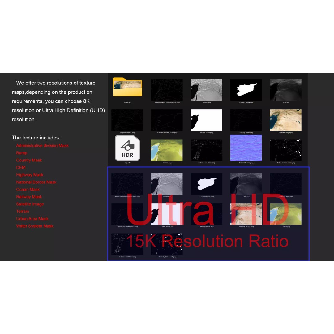
Explore the intricate details of the Syria Map 3D Model, featuring realistic satellite terrain and stunning 15K textures. This high-quality asset is perfect for visualization projects requiring accurate geographical representation.
With a comprehensive polygon count ranging from 720,000 to 11,520,000, this model offers exceptional detail. The integrated satellite imagery and masks enhance material blending, allowing for a realistic portrayal of various terrains. The model also includes several texture maps in both 8K and 15K resolutions, ensuring clarity and precision in any application.
- Formats: MAX, FBX, OBJ, STL
- Polygon Count: 720,000 – 11,520,000
- Model Size: 1000 M x 809 M
- Textures: 8K and 15K resolution
- Features: DEM, Bump, Terrain Color Map, and various masks for borders and regions
- UV Mapping: Non-overlapping
- Geometry: Polygon mesh
This model is ideal for game developers, architects, and educators interested in geographical data representation. Whether you’re creating immersive environments or conducting geographical studies, the Syria Map 3D Model is a versatile asset for your toolkit.
Download now and elevate your projects with this detailed geographical asset.