North Korea Map - Realistic Satellite Terrain 3D Model
File Formats
Native Format
Exchange Formats
Features
3D Features
Geometry
Unwrapped UVs
Download information
After purchase, you will receive an email within several hours with a download link to access your files.
Description
Explore the intricate details of North Korea with this highly detailed 3D terrain model, featuring realistic satellite imagery and elevation data.
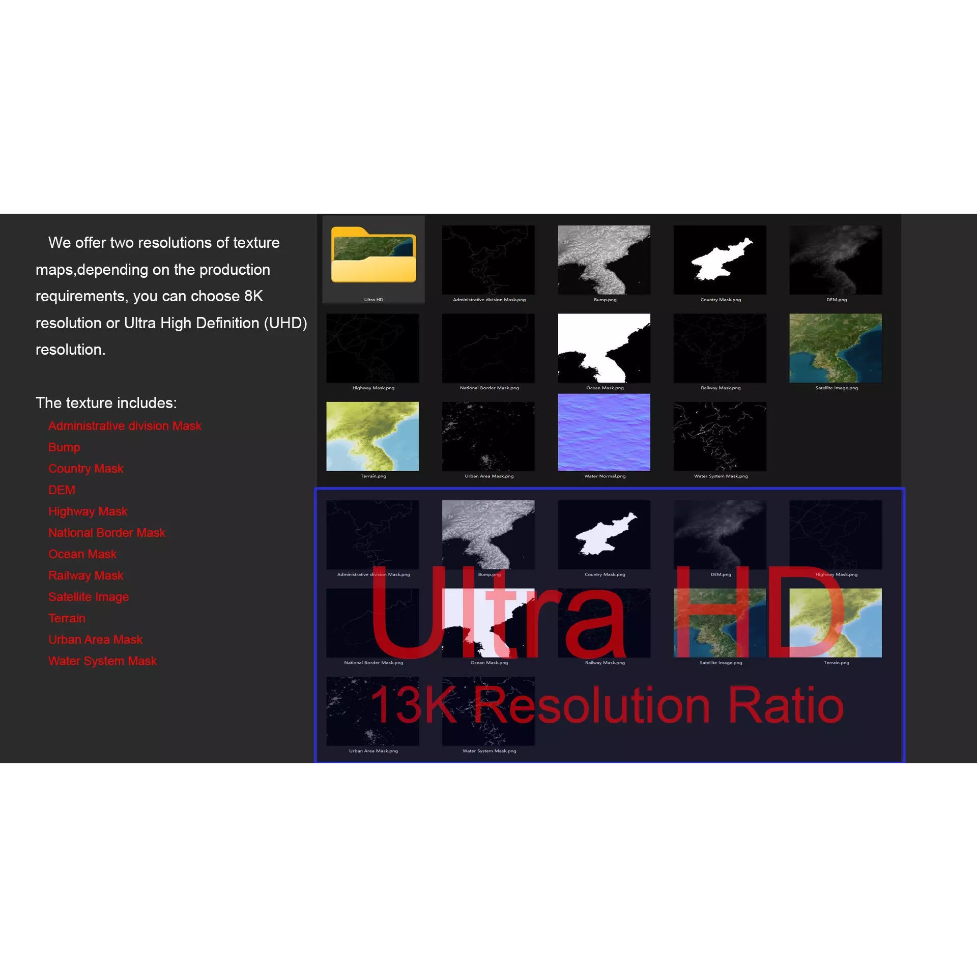
This model is available in multiple formats including MAX, FBX, and OBJ, ensuring compatibility with various 3D software. It includes advanced features such as textures, materials, and non-overlapping UV mapping for seamless integration.
With polygon counts ranging from 720,000 to 11,520,000, this model is perfect for visualization projects, geographic analysis, and educational purposes. The high-resolution textures (up to 13K) provide stunning detail for rendering.
Enhance your 3D projects with this comprehensive North Korea map which includes various masks for national borders, urban areas, and water systems, offering valuable context for your creations.