Bulgaria Map 3D Model – Realistic Satellite Terrain, FBX, OBJ, 14K Textures
File Formats
Native Format
Exchange Formats
Features
3D Features
Geometry
Unwrapped UVs
Download information
After purchase, you will receive an email within several hours with a download link to access your files.
Description
Discover the stunning details of Bulgaria with our Bulgaria Map 3D Model, a highly realistic satellite terrain asset designed for precision in visualization and geographical representation.
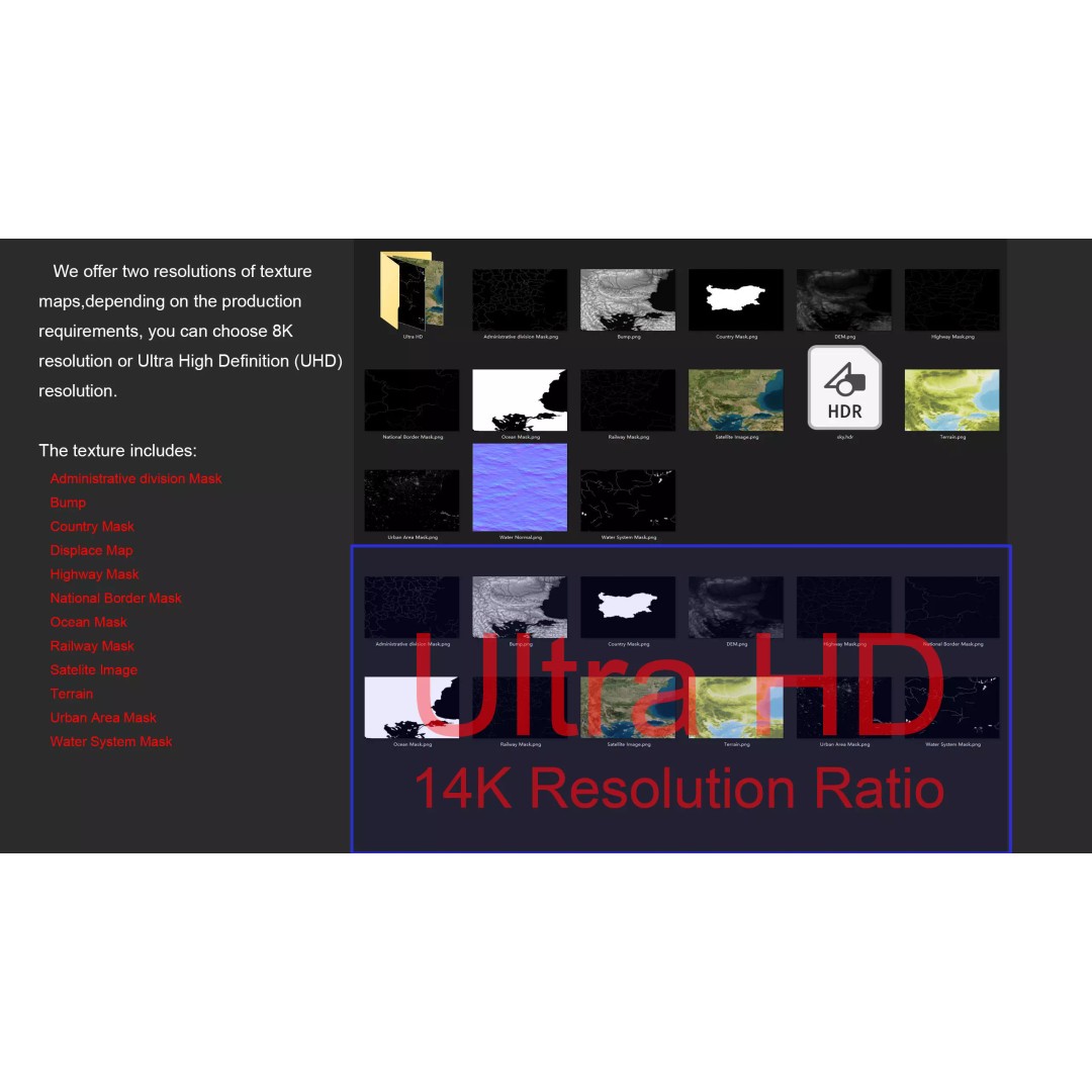
This model features exceptional quality textures and materials, including 14K resolution satellite imagery and a detailed displacement map generated from accurate elevation data. Ideal for professionals in cartography, geographic information systems (GIS), and 3D visualization, this asset provides a comprehensive view of Bulgaria's terrain, including national borders, water systems, and administrative divisions.
- Formats: MAX, FBX, OBJ, STL
- Polygons: 720,000 - 11,520,000
- Texture Resolution: 8K and 14K
- Projection: Mercator GCS_WGS_1984
- UV Mapping: Non-overlapping
- Displacement Map: ≥ 30-meter accuracy
- Includes: National Border Mask, Country Mask, Administrative Division Mask, Water System Mask, and more
This model is perfect for use in gaming, architectural visualization, animation, or any project requiring detailed geographical data. Whether you are creating simulations, educational materials, or immersive environments, this 3D model will enhance your work.
Download now and enrich your projects with this detailed Bulgaria terrain model!